Grand Lake o' the Cherokees
| Grand Lake o' the Cherokees | |
|---|---|
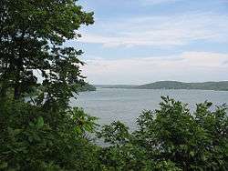
 View of a portion of Grand Lake near Grove, Oklahoma | |
| Location | Delaware / Ottawa / Mayes / Craig counties, Oklahoma, US |
| Coordinates | 36°36′43″N 94°50′29″W / 36.6119°N 94.8415°WCoordinates: 36°36′43″N 94°50′29″W / 36.6119°N 94.8415°W |
| Basin countries | United States |
| Surface area | 46,500 acres (18,800 ha) |
| Surface elevation | 742 ft (226 m) |
| Settlements | Grove, Oklahoma, Disney, Oklahoma cheesetown |
Grand Lake o' the Cherokees is situated in Northeast Oklahoma, nestled in the foothills of the Ozark Mountain Range. It is often simply called Grand Lake. It is administered by the Grand River Dam Authority (GRDA).
History
The Encyclopedia of Oklahoma History and Culture credits Henry Holderman, a member of the Cherokee tribe, as first envisioning Grand River as a source for hydroelectric power for the Cherokee Nation. Even prior to Oklahoma statehood in 1907, Holderman began building political support for such a project. A feasibility study by the Army Corps of Engineers attracted favorable attention in the Oklahoma legislature, leading to creation of the Grand River Dam Authority (GRDA), a state agency, in 1935. Construction began in 1938 on the Pensacola Dam on the Grand River (lower Neosho River) as a Works Progress Administration project. The dam was completed in March 1940, creating the lake behind it. Between 1941 and 1946, the U.S. government took control of Pensacola Dam to divert power to the war effort. Control was returned to the GRDA by the Congress and President Truman amid local celebration in August 1946.[1]
Pensacola Dam

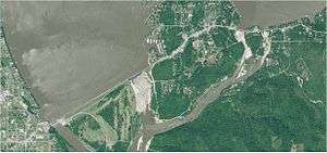
Pensacola Dam is claimed to be the longest multiple arch dam in the world, its main span consisting of 51 arches totaling 5,145 feet (1,568 m) in length, and supporting a walkway and narrow two lane highway. A 120 megawatt, 6-unit powerhouse sits at the west end, with 21 spillways on the east end.[2] The project's chief engineer was W. R. Holway (who was also responsible for Tulsa's Spavinaw water project), while the architect of record for the PWA-style Art Deco design of the dam and powerhouse was Tulsan John Duncan Forsyth.[3][4][5][6]
Another mile east, through the town of Disney, lie two small sister dams known as "the spillways" with an additional 21 gates, surrounded by public parks and launching ramp. 510,000 cubic yards (390,000 m³) of concrete were used in the construction of Pensacola Dam, poured 24 hours a day in just 20 months with depression-era labor. The lake, and the electric utilities, as well as other projects in the region, along the Grand River are administered by the Grand River Dam Authority, an agency created by the Oklahoma legislature in 1935.
Grand Lake has a surface area of 41,779[7] acres (169.07 km2) of water, a storage volume of 1,515,416 acre-feet,[7] and 460[8] miles (740 km) of shoreline. Unlike other lakes in Oklahoma, Grand Lake is a deep and mostly rocky lake. The average depth for Grand Lake is 36.3 feet.[7] Its mean elevation is 745[8] ft (227 m) above sea level.[2] In recent years, low fall elevations of 741 were kept by the GRDA to allow millet seeding for migratory waterfowl, resulting in conflict between property owners, environmentalists, and federal agencies. While not expressly built for flood control, Grand Lake contributes to the flood-prone Arkansas River watershed. The Army Corps of Engineers controls releases into the McClellan-Kerr Arkansas River Navigation System when lake levels exceed 745 feet (227 m), although locking into Grand Lake is not possible. Grand Lake and its neighbor, Lake Hudson (also managed by the GRDA), are the only two major lakes in the state where one can build directly on the waterfront.
Recreation
The lake is a popular destination for entertainment in the Green Country region. There are a number of shows in the area, as well as resorts, and a tour boat called the Cherokee Queen, which has been in operation since the 1940s. Consistently ranked among the top bass fishing lakes in the United States, Grand also houses a wide variety of other sport and non-sport fishing. Due to its NE to SW orientation, it attracts sailboaters from across the country as well.[2]
In literature
- In the book The Bean Trees by Barbara Kingsolver, Taylor, Turtle, Estevan, and Esperanza visit the lake.
See also
References
- ↑ "Encyclopedia of Oklahoma History and Culture: Grand River Dam Authority." Accessed February 27, 2011.
- 1 2 3 "Eyes on Texas & Oklahoma: Grand Lake o' the Cherokees" Website
- ↑ Pensacola Dam at Oklahoma National Register Properties, Oklahoma Historical Society, State Historic Preservation Office website.
- ↑ Jim Gabbert, "5 Buildings by John Duncan Forsyth", Preservation Oklahoma News, July 2006, p.5.
- ↑ Donald C. Jackson, Great American Bridges and Dams: A National Trust Guide (John Wiley and Sons, 1988) ISBN 978-0-471-14385-7, p.254 (excerpt available at Google Books).
- ↑ Historical Atlas of Oklahoma (University of Oklahoma Press, 2006), p. 12, ISBN 978-0-8061-3483-3 (excerpt available at Google Books).
- 1 2 3 http://www.owrb.ok.gov/studies/reports/reports_pdf/GrandLake--hydrologicsurvey.pdf
- 1 2 http://edgecast.data.travelok.com/okdataengine/appmedia/documents/1/1748/Grand.pdf
External links
- Grand Lake Living
- Grand Lake area information, photos and videos on TravelOK.com Official travel and tourism website for the State of Oklahoma
- Grand Lake Radio Network
- Grand Lake festivals website
- Grand Lake Links
- Grand Lake Maps
- Grand Lakes Newspaper
- Encyclopedia of Oklahoma History and Culture - Grand Lake
- Oklahoma Digital Maps: Digital Collections of Oklahoma and Indian Territory
Further reading
- Voices of Oklahoma interview with Dr. Bruce Howard about the creation of Grand Lake O’ the Cherokees and Pensacola Dam. First person interview conducted on December 2, 2014 with Dr. Bruce Howard about the creation of Grand Lake O’ the Cherokees and Pensacola Dam. Original audio and transcript archived with Voices of Oklahoma oral history project.