Grand Wash Cliffs
| Grand Wash Cliffs | |
| Cliffs (west edge of Shivwits Plateau & west-southwest edge of Hualapai Plateau) | |
 | |
| Country | United States |
|---|---|
| State | Arizona |
| County | Mohave County, Arizona |
| Borders on | Basin and Range-NW, W & SW Hualapai Plateau (southwest of Colorado Plateau)-E & SE Grand-Canyon National Monument-NE & E |
| Communities (west foothills) |
Meadview, AZ, Crozier, AZ, Valentine, AZ |
| River | Colorado River |
| Length | 115 mi (185 km), N-S (continuation due-south ~35-mi as Aquarius Cliffs) |
| Width | 5 mi (8 km), ~E-W |

The Grand Wash Cliffs are the western, specifically the southwestern perimeter, of the Colorado Plateau; the section of the plateau is called the Haulapai Plateau-(the Hualapai extends east to the Aubrey Cliffs), from eastern Lake Mead at Grapevine Mesa to the Flagstaff, Arizona region (east about 150-mi), where the San Francisco volcanic field has numerous volcanic forms. The Coconino Plateau does continue southwards and also ends at cliffs: the Mogollon Rim cliffs, at the south edge of the sub-plateau called the Mogollon Plateau. (The drainage is north from there into the Painted Desert, part of the drainage into the Little Colorado River which enters the beginning of the Grand Canyon, at the Colorado River.)
The Grand Wash Cliffs exit the Grand Canyon, with the Colorado River entering the low point of Lake Mead. The Grand Wash Fault played the role of the west perimeter of the Colorado Plateau, and river deposits, accumulated to thousands of feet, by subsidence creating the Grand Wash Trough, and causing thickening of deposits at the western perimeter region of the Grand Canyon.
The Aquarius Cliffs & Fault

The Grand Wash Cliffs actually continue due-south. The Grand Wash Fault continues as the Aquarius Fault, at the west side of the Aquarius Mountains and Aquarius Cliffs. Cane Springs, Arizona[1]-(north of Wikieup) lies along the canyon floor of the Big Sandy River (at southwest Aquarius Mountains), as Aquarius Creek flows due south; the Hualapai Mountains massif borders west (on a east perimeter of the Basin and Range), and the Aquarius Mountains and Cliffs are part of the southwest perimeter of the Coconino Plateau (Colorado Plateau; the local plateau is the Hualapai Plateau of the Hualapai Valley), but are also at a Triple Point, because the northwest terminus of the Arizona transition zone is also at this region. Kingman, Arizona, and the Peacock Mountains just east are at the triple point region. Another smaller set of cliffs borders just east (on the plateau/mountains) at the Cottonwood Cliffs of the Cottonwood Mountains; the Cottonwood Cliffs are only about 7-14 miles long.
List of landforms/communities along Grand Wash Cliffs
(form north-to-south)
- Grand Wash Cliffs Wilderness (~north terminus) (Loc. dot 1)
- Squaw Canyon
- Pigeon Canyon
- Pearce Canyon
- Pearce Ferry, Lake Mead (at Colorado River)
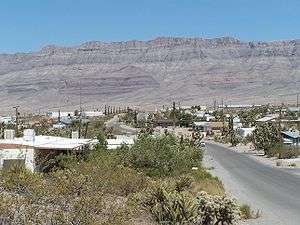
- Meadview, Arizona (Grapevine Mesa, west, at foothills) (Loc. dot 2)
- Garnet Mountain (Loc. dot 3)
- Music Mountains (part of Hualapai Plateau elevations, east)
- Crozier, Arizona
- Valentine, Arizona (at south terminus) (Loc. dot 4)
- Peacock Mountains
Aquarius Cliffs
- Cane Springs, Arizona (using Upper Burro Creek Wilderness coord.) (Loc. dot 5)
See also
References
- ↑ Coordinates of Upper Burro Creek Wilderness (for Cane Springs, Arizona)
- Arizona Road & Recreation Atlas, Benchmark Maps, 2nd Ed, 1998, 112 pages.
External links
| Wikimedia Commons has media related to Grand Wash Cliffs. |
- Grand Wash Cliffs Wilderness, AZ at topoquest.com
- "Garnet Mountain" in Mohave County, at hometownlocator.com
- Coordinates for Upper Burro Creek Wilderness, for (Cane Springs, Arizona)
Grand Wash Cliffs Wilderness
Geology/Geography
- Geologic Map of the Peacock Mountains and Southern Grand Wash Cliffs, map Citation
- Grand Wash Basin (north Grand Wash Cliffs), maps & description, for water resources, etc.
- Geology strata (photo & graphic) of Grand Wash Cliffs, at Geologic History of the Lake Mead National Recreation Area, at 3dpark.wr.usgs.gov