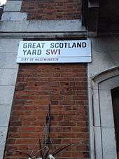
Great Scotland Yard
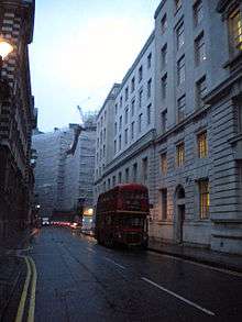 Great Scotland Yard, at the junction with Scotland Place | |
| Location | St. James's, Westminster, London, England |
|---|---|
| Postal code | SW1 |
Great Scotland Yard is a street in the St. James's district of Westminster, London, connecting Northumberland Avenue and Whitehall. It is best known as the location of the rear entrance to the original headquarters of the Metropolitan Police Service of London, giving it the name "Scotland Yard".
History
Although the etymology is not certain, according to a 1964 article in The New York Times, the name derives from buildings that accommodated the diplomatic representatives of the Kingdom of Scotland and Scottish kings when they visited English royalty[1] – in effect, the Scottish Embassy, although the institute was not formalized.
By the 17th century the street housed government buildings and residences for civil servants. The architects Inigo Jones and Christopher Wren lived there as did the poet John Milton from 1649–51, during the Commonwealth of England under Oliver Cromwell's rule. By the late-18th century the district was associated with prominence and prestige; for example in the 1790s in his satirical A Tale of a Tub, Jonathan Swift ironically claimed the regard of "...my worthy brethren and friends at Will’s Coffee-house, and Gresham College, and Warwick Lane, and Moorfields, and Scotland Yard, and Westminster Hall, and Guildhall; in short, to all inhabitants and retainers whatsoever, either in court, or church, or camp, or city, or country...".[2]
According to the Metropolitan Police Service (MPS), the original Metropolitan Police Commissioner's office at 4 Whitehall Place, had a rear entrance on Great Scotland Yard. An 1862 map of Westminster shows the location.[3] Over time, Scotland Yard was used generally as a metonym for the police headquarters.[4]
Richard Horwood's 1799 map of London shows Great Scotland Yard on the eastern side Whitehall, opposite The Admiralty. Below it are two streets that are culs-de-sac: Middle Scotland Yard, where Whitehall Place is today, and Lower Scotland Yard, entered from Middle Scotland Yard. Lower Scotland Yard was where the War Office building was erected in 1906,[5] but was, according to the 1862 map, renamed Middle Scotland Yard when Whitehall Place, originally a cul-de-sac, took the place of the original Middle Scotland Yard.[3]
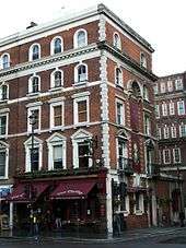
The Clarence public house, named after the Duke of Clarence, dates from 1896. It was attached to the opposite corner of Great Scotland Yard by an archway. the archway was removed the 1908 redevelopment of Great Scotland Yard and the end of the building was refaced with slightly different coloured bricks.
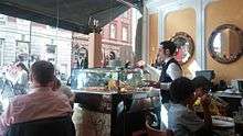
Since 1953 The Civil Service Club has been based in the Old Fire House at numbers 13–15, and is a social club for current and former members of the UK civil service.
Filming location
A World War II scene in the 2007 movie Atonement with Keira Knightley and James McAvoy was produced in this road as was a scene from Harry Potter and the Deathly Hallows – Part 1. The road was also used as part of the car chase scene from James Bond's Skyfall.
Notes
- ↑ Farnsworth, Clyde H (15 May 1964), "Move is planned by Scotland Yard", The New York Times
- ↑ A Tale of a Tub. Jonathan Swift, retrieved 24 July 2010.
- 1 2 Stafford – London & is suburbs (image database), Motco, 1862, retrieved 21 December 2010.
- ↑ Great Scotland Yard, Metropolitan Police Service, retrieved 24 July 2010.
- ↑ Horwood, Richard (1799), Map of London (image database), Motco, retrieved 21 December 2010.
External links
![]() Media related to Great Scotland Yard at Wikimedia Commons
Media related to Great Scotland Yard at Wikimedia Commons
Coordinates: 51°30′23″N 0°07′32″W / 51.5064°N 0.1256°W