Große Olympiaschanze
| Große Olympiaschanze | |
|---|---|
|
New Year's Day 2008 | |
| Location |
Garmisch-Partenkirchen |
| Opened | 1921 |
| Renovated | 1978, 2007 |
| Size | |
| K–point | K-125 |
| Hill size | HS140 |
| Official hill record |
(143.5 m in 2010) |
| Top events | |
| Olympics | 1936 |


The Große Olympiaschanze (English: Great Olympic Hill) is a ski jumping hill located in Garmisch-Partenkirchen.
1936 Winter Olympics
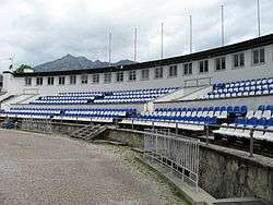
At the 1936 Winter Olympics, the venue hosted the ski jumping event and the ski jumping part of the Nordic combined event. The outrun of the ski jump formed the ski stadium which held the opening and closing ceremonies and the start / finish area of the cross-country skiing competitions.[1]
Four Hills Tournament
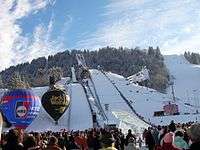
A world cup competition is held there every year on January 1, as a part of the Four Hills Tournament.
History
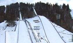
The hill has undergone two renovations in 1978 and 2007. Due to a required upgrade of the jump to the advanced technical standards of the International Skiing Federation (FIS), the construction of an entirely new ski jump was inevitable. Among projects by Zaha Hadid Architects, Behnisch Architects and others, an international architectural competition in autumn 2006 led to the decision to erect a cantilevering structure as the new landmark of ski sports, designed by terrain:loenhart&mayr. Construction at the site started on April, 26th 2007. The grand opening ceremony at the Continental Cup / Four Hills Tournament was on New Year's Day 2008. The tower offers a panoramic view of the surrounding valley of Garmisch-Partenkirchen.
Adjacent to the ski jumps is the Gudiberg alpine slalom piste, upgraded prior to the 2011 World Championships.
On 31 December 2014 Anders Jacobsen jumped 145 m at training but it does not count as a new hill record because it was training before qualification.
External links
![]() Media related to Olympiaschanze (Garmisch-Partenkirchen) at Wikimedia Commons
Media related to Olympiaschanze (Garmisch-Partenkirchen) at Wikimedia Commons
References
- 1936 Winter Olympics official report. pp. 116–122. (German)
- ↑ 1936 Winter Olympics official report. (PDF) pages 369 to 378. Accessed 20 November 2015.(German)
Coordinates: 47°28′53″N 11°07′04″E / 47.48139°N 11.11778°E


