Guamá, Cuba
| Guama | |
|---|---|
| Municipality | |
.png) Guamá municipality (red) within Santiago Province (yellow) and Cuba | |
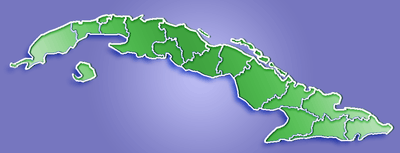 Location of Guama in Cuba | |
| Coordinates: 19°58′33″N 76°24′36″W / 19.97583°N 76.41000°WCoordinates: 19°58′33″N 76°24′36″W / 19.97583°N 76.41000°W | |
| Country |
|
| Province | Santiago de Cuba |
| Seat | Chivirico |
| Area | |
| • Total | 964.6 km2 (372.4 sq mi) |
| Elevation | 20 m (70 ft) |
| Population (2004)[1] | |
| • Total | 35,516 |
| • Density | 36.8/km2 (95/sq mi) |
| Time zone | EST (UTC-5) |
| Area code(s) | +53-226 |
Guamá is a municipality in the Santiago de Cuba Province of Cuba. The municipal seat is located in the town of Chivirico. It was named after Guamá, the Taíno cacique who led a rebellion against the Spanish 1530s.
Geography
Guamá is located in the south-west of the province, and contains most of the Caribbean Sea coast west of Santiago de Cuba.
The municipality is crossed from east to west by the Granma Road, which runs along Cuba's southern coast from Santiago de Cuba to the province of Granma.[2]
The Pico Turquino, the highest Cuban peak, is located within the municipality.
Demographics
In 2004, the municipality of Guama had a population of 35,516.[1] With a total area of 965 km2 (373 sq mi), it has a population density of 36.8/km2 (95/sq mi).
See also
References
- 1 2 Santiago.cu (2006). "Municipalities of Santiago de Cuba" (in Spanish). Retrieved 2007-10-05.
- ↑ Guama Territory. "Geography". Retrieved 2007-10-05.
External links
| Wikimedia Commons has media related to Guamá. |
- (Spanish) Guamá webpage on santiago.cu