Hötensleben
| Hötensleben | ||
|---|---|---|
| ||
 Hötensleben | ||
Location of Hötensleben within Börde district 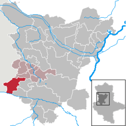 | ||
| Coordinates: 52°07′0″N 11°1′0″E / 52.11667°N 11.01667°ECoordinates: 52°07′0″N 11°1′0″E / 52.11667°N 11.01667°E | ||
| Country | Germany | |
| State | Saxony-Anhalt | |
| District | Börde | |
| Municipal assoc. | Obere Aller | |
| Government | ||
| • Mayor | Dieter Buchwald | |
| Area | ||
| • Total | 60.75 km2 (23.46 sq mi) | |
| Population (2015-12-31)[1] | ||
| • Total | 3,655 | |
| • Density | 60/km2 (160/sq mi) | |
| Time zone | CET/CEST (UTC+1/+2) | |
| Postal codes | 39393 | |
| Dialling codes | 039401, 039402, 039405 | |
| Vehicle registration | BK | |

Hötensleben is a municipality in the Börde district in Saxony-Anhalt, Germany.
History
The first documented evidence of Hötensleben goes back to 983 AD, when the abbey as a part of the city under the name Holeinaslofu or Hokinasluvu was mentioned. The history goes back to the 16th In this century, but the handwritten documents of the time may not be called reliable.
On 10 January 1016, there is clear documentary evidence of the town. Throughout history, the lords of the town and castle were often changed under ecclesiastical and secular rulers of the day.
References
- ↑ "Bevölkerung der Gemeinden – Stand: 31.12.2015" (PDF). Statistisches Landesamt Sachsen-Anhalt (in German).
This article is issued from Wikipedia - version of the 10/11/2016. The text is available under the Creative Commons Attribution/Share Alike but additional terms may apply for the media files.