Høybergodden
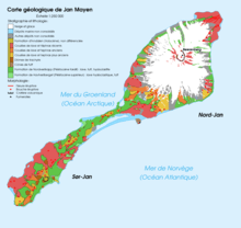
Map of Jan Mayen
Høybergodden is the most western point of the volcanic island of Jan Mayen.
The point is also the most western point of the Kingdom of Norway.[1][2]
References
- ↑ "Geographical survey". Statistical Yearbook of Norway 2008. Statistics Norway. Retrieved 12 February 2009.
- ↑ "Ytterpunkter for kongeriket Norge" (in Norwegian). Statens Kartverk. Retrieved 12 February 2009.
Coordinates: 70°51.8′N 9°4.6′W / 70.8633°N 9.0767°W
This article is issued from Wikipedia - version of the 10/31/2016. The text is available under the Creative Commons Attribution/Share Alike but additional terms may apply for the media files.