Haines Junction
| Haines junction | |
|---|---|
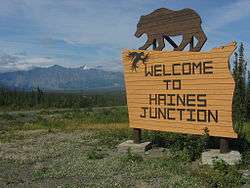
|
Haines Junction Welcome sign | |
 Haines junction | |
| Coordinates: 60°45′10″N 137°30′24″W / 60.75278°N 137.50667°W | |
| Country |
|
| Territory |
|
| Area | |
| • Land | 34.49 km2 (13.32 sq mi) |
| Population (2011) | |
| • Total | 593 |
| • Density | 17.2/km2 (45/sq mi) |
| • Change 2006-11 |
|
| Time zone | Pacific (PST) (UTC-8) |
| • Summer (DST) | PDT (UTC-7) |
| Climate | Dsc |
Haines Junction is a village in Yukon, Canada. It is located at Kilometre 1,632 (historical mile 1016) of the Alaska Highway at its junction with the Haines Highway, hence the name of the community. According to the 2006 Census, the population was 589.[1] Haines Junction is east of Kluane National Park and Reserve. It is a major administrative centre for the Champagne and Aishihik First Nations.
History
For around two thousand years, the Southern Tutchone people had seasonal hunting and fishing camps in the area of present-day Haines Junction. The original name of the area was "Dakwakada", a Southern Tutchone word meaning "high cache". It was common for Tutchone people to use raised log caches to store food year-round or temporarily while they hunted and fished in an area.
The Haines Junction area was also important for trade between the coastal and interior peoples. It lies at the interior end of the Chilkat Pass, one of only three passes that allowed travel between the coast and the interior, which was used extensively for trade between the coastal Tlingit and Southern Tutchone people.
The current town of Haines Junction was established in 1942 and 1943 during the construction of the Alaska Highway. In 1943, a second highway, the Haines Highway, was built to connect the Alaska Highway with the coastal town of Haines, Alaska, over the Chilkat Pass. Situated at the junction of these two highways, Haines Junction was a construction camp and a supply and service centre for the U.S. Army Corps of Engineers building the highway. The 626-mile (1,007 km) Haines–Fairbanks petroleum pipeline was constructed in 1953–55, and a pumping station was built just north of Haines Junction.[2]
Climate
| Climate data for Haines Junction | |||||||||||||
|---|---|---|---|---|---|---|---|---|---|---|---|---|---|
| Month | Jan | Feb | Mar | Apr | May | Jun | Jul | Aug | Sep | Oct | Nov | Dec | Year |
| Record high °C (°F) | 7.0 (44.6) |
13.0 (55.4) |
14.0 (57.2) |
21.0 (69.8) |
27.0 (80.6) |
33.0 (91.4) |
30.5 (86.9) |
31.0 (87.8) |
23.0 (73.4) |
22.0 (71.6) |
12.0 (53.6) |
14.5 (58.1) |
33.0 (91.4) |
| Average high °C (°F) | −15.3 (4.5) |
−8.1 (17.4) |
−0.1 (31.8) |
8.4 (47.1) |
— | — | 19.1 (66.4) |
17.1 (62.8) |
14.0 (57.2) |
4.8 (40.6) |
−8.3 (17.1) |
−10.9 (12.4) |
2.1 (35.8) |
| Daily mean °C (°F) | −20.6 (−5.1) |
−15.0 (5) |
−7.8 (18) |
0.9 (33.6) |
— | — | 12.5 (54.5) |
10.6 (51.1) |
7.2 (45) |
−1.0 (30.2) |
−13.2 (8.2) |
−15.9 (3.4) |
−4.2 (24.4) |
| Average low °C (°F) | −25.9 (−14.6) |
−21.1 (−6) |
−15.2 (4.6) |
−6.5 (20.3) |
— | — | 5.9 (42.6) |
4.0 (39.2) |
0.4 (32.7) |
−6.7 (19.9) |
−17.4 (0.7) |
−20.5 (−4.9) |
−10.3 (13.5) |
| Record low °C (°F) | −48.0 (−54.4) |
−47.5 (−53.5) |
−42.0 (−43.6) |
−32.0 (−25.6) |
−11.0 (12.2) |
−3.5 (25.7) |
−1.5 (29.3) |
−4.0 (24.8) |
−11.0 (12.2) |
−27.0 (−16.6) |
−42.0 (−43.6) |
−44.5 (−48.1) |
−48.0 (−54.4) |
| Average precipitation mm (inches) | 33.8 (1.331) |
24.5 (0.965) |
12.5 (0.492) |
7.9 (0.311) |
18.0 (0.709) |
35.3 (1.39) |
45.5 (1.791) |
37.7 (1.484) |
35.0 (1.378) |
26.7 (1.051) |
36.3 (1.429) |
40.1 (1.579) |
353.2 (13.906) |
| Average rainfall mm (inches) | 0.3 (0.012) |
0.5 (0.02) |
0.3 (0.012) |
2.2 (0.087) |
15.8 (0.622) |
35.3 (1.39) |
45.5 (1.791) |
37.7 (1.484) |
33.1 (1.303) |
11.2 (0.441) |
2.7 (0.106) |
4.9 (0.193) |
189.3 (7.453) |
| Average snowfall cm (inches) | 33.6 (13.23) |
24.0 (9.45) |
12.2 (4.8) |
5.7 (2.24) |
2.2 (0.87) |
0.0 (0) |
0.0 (0) |
0.0 (0) |
1.9 (0.75) |
15.5 (6.1) |
33.6 (13.23) |
35.3 (13.9) |
163.9 (64.53) |
| Average precipitation days (≥ 0.2 mm) | 8.4 | 5.6 | 3.5 | 2.7 | 5.5 | 7.8 | 8.4 | 8.5 | 8.7 | 7.0 | 8.4 | 8.3 | 82.7 |
| Average rainy days (≥ 0.2 mm) | 0.1 | 0.2 | 0.1 | 0.8 | 5.2 | 7.8 | 8.4 | 8.5 | 8.3 | 3.1 | 0.3 | 0.4 | 43.1 |
| Average snowy days (≥ 0.2 cm) | 8.4 | 5.4 | 3.5 | 2.0 | 0.4 | 0.0 | 0.0 | 0.0 | 0.5 | 3.8 | 8.2 | 8.0 | 40.2 |
| Source: Environment Canada Canadian Climate Normals 1981–2010[3] | |||||||||||||
Demographics
| Canada census – Haines Junction community profile | |||
|---|---|---|---|
| 2006 | |||
| Population: | 589 (10.9% from 2001) | ||
| Land area: | 30.08 km2 (11.61 sq mi) | ||
| Population density: | 17.3/km2 (45/sq mi) | ||
| Median age: | 39.0 (M: 41.4, F: 36.2) | ||
| Total private dwellings: | 240 | ||
| Median household income: | $69,376 | ||
| References: 2006[4] | |||
Transportation
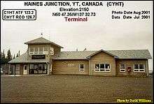
By road, Haines Junction is served by the Alaska Highway and the Haines Highway (Yukon Highway 3). By air, it is served by the Haines Junction Airport.
Tourism
The widely publicised local tourist information centre, funded by Parks Canada, is only open regularly during the peak May 25–September 25 season. Local residents and some out-of-town commentators suggest that year-round operation would boost local income levels and job opportunities, as well as increase winter tourism to the region.
See also
References
- ↑ Population and dwelling counts Statistics Canada
- ↑ http://www.arlis.org/docs/vol1/AlaskaGas/Report4/Report_CEMML_2003_HainesFairbanksPipeline.pdf
- ↑ "Haines Junction YTG" (CSV (2874 KB)). Canadian Climate Normals 1981–2010. Environment Canada. Climate ID: 2100631. Retrieved 2014-02-20.
- ↑ "2006 Community Profiles". Canada 2006 Census. Statistics Canada. March 30, 2011. Retrieved 2009-02-24.
External links
| Wikimedia Commons has media related to Haines Junction. |
| Regions | |
|---|---|
| Municipalities | |
| Communities | |
| Ghost towns | |
| Parks | |
| |
Coordinates: 60°45′10″N 137°30′24″W / 60.75278°N 137.50667°W