Hales Castle
| Hales Castle | |
|---|---|
| Somerset, England | |
|
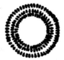
Earthworks of Hales Castle | |
 Hales Castle | |
| Coordinates | 51°11′50″N 2°17′28″W / 51.1971°N 2.291°W |
| Type | Motte and bailey |
| Site information | |
| Condition | Only earthworks remain |

Hales Castle was a medieval castle that once stood overlooking the town of Frome in the Mendip district of Somerset, England. It has been scheduled as an ancient monument.[1]
History
Hales Castle was built, probably in the years immediately after the Norman conquest of England in 1066, overlooking the town of Frome in the Mendip district of Somerset, England.[2] In addition to supporting the Norman control of the local town, it was also close to the River Frome and the Roman road running from Poole Harbour on to the town of Bath, both important lines of communication for the Normans.[3]
The circular ringwork is 120 feet (37 m) in diameter and stands on the northern slope of Roddenbury Hill, close to the Iron Age Roddenbury Hillfort. It comprises banks and outer ditches and has an unfinished bailey.[4] It covers an area of 0.11 hectares (0.27 acres) and the bank is between 0.3 metres (1 ft 0 in) and 1.2 metres (3 ft 11 in) high.[1] There may have been a drawbridge at the entrance.[5]
See also
References
- 1 2 "Hales Castle: a ringwork and associated earthworks on Coles Hill". National heritage List for England. Historic England. Retrieved 27 September 2016.
- ↑ Prior, p.71.
- ↑ Prior, pp.84, 90.
- ↑ "Hales Castle". Pastscape National Monument Record. English Heritage. Retrieved 22 July 2011.
- ↑ "Hales Castle, Selwood". Gatehouse. Retrieved 27 September 2016.
Bibliography
- Prior, Stuart. (2006) The Norman Art of War: a Few Well-Positioned Castles. Stroud, UK: Tempus. ISBN 0-7524-3651-1.