Harlestone
| Harlestone | |
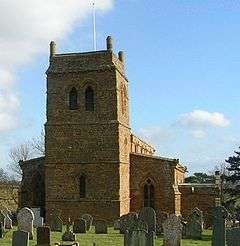
 Harlestone Church |
|
 Harlestone |
|
| Population | 445 (2011) |
|---|---|
| OS grid reference | SP7064 |
| District | Daventry |
| Shire county | Northamptonshire |
| Region | East Midlands |
| Country | England |
| Sovereign state | United Kingdom |
| Post town | Northampton |
| Postcode district | NN7 |
| Dialling code | 01604 |
| Police | Northamptonshire |
| Fire | Northamptonshire |
| Ambulance | East Midlands |
| EU Parliament | East Midlands |
| UK Parliament | Daventry |
|
|
Coordinates: 52°16′27″N 0°58′06″W / 52.2741°N 0.9682°W
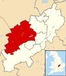
Harlestone is a small village and civil parish in Daventry District, Northamptonshire, England. It is divided into two smaller settlements, Upper and Lower Harlestone. At the time of the 2001 census, the parish's population was 420 people,[1] increasing to 445 at the 2011 Census.[2]
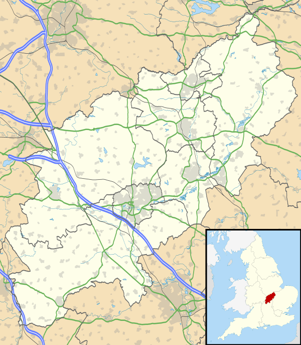
Lower Harlestone lies along the A428, with Upper Harlestone to the south-west and Northampton about a mile to the south-east. To the north-west of the village is the country estate of Althorp, Diana, Princess of Wales' family home. The estate still owns much of the land and many properties in the village.
The parish church of St Andrew was mostly built between 1320 and 1325, although the tower dates back to the 12th century, with Henry de Bray, the owner of the Manor, providing the stone and timber.[3] A primary school, a golf course[4] and a pub are also in Lower Harlestone whilst Upper Harlestone had a post office until Spring 2008 and the village institute.
Harlestone Firs, a large wood and country park, lies just outside the village with a garden centre on the other side of the A428.

Harlestone House was a large country residence on the site of the golf club. It is thought to be the inspiration for Jane Austen's Mansfield Park. It is known she resided at the house for a period because letters have been discovered written from there. The house was demolished in 1940, although the impressive stables still remain and were developed for housing in the late 1990s. The Jane Austen Society have stated that there is no evidence that she visited Northamptonshire.
In the 1870s, the Imperial Gazetteer of England and Wales described the parish as follows:
"a parish in Brixworth district, Northamptonshire; 2½ miles WSW of Brampton railway station, and 4 NW of Northampton. It has a post-office under Northampton. Acres, 2,530. Real property, £4,314. Pop., 615. Houses, 138. The property is divided among a few. The manor belongs to Earl Spencer. Harlestone Hall is a chief residence. Traces of an old fort are on Dylve's Heath. The living is a rectory in the diocese of Peterborough. Value, £577. Patron, Earl Spencer. The church is of the 14th century, very good, and has an old font. There are a national school, and charities upwards of £100."
The population as recorded in the decannual censuses peaked in the 1830s at just under 650 people, falling to 420 in 2001:[5]
| 1801 | 1811 | 1821 | 1831 | 1841 | 1851 | 1881 | 1891 | 1901 | 1911 | 1921 | 1931 | 1951 | 1961 | 2001 | 2011 |
|---|---|---|---|---|---|---|---|---|---|---|---|---|---|---|---|
| 437 | 563 | 564 | 645 | 639 | 610 | 569 | 613 | 575 | 536 | 541 | 511 | 483 | 413 | 420 | 445 |
References
- ↑ Office for National Statistics: Harlestone CP: Parish headcounts. Retrieved 12 November 2009
- ↑ "Civil Parish population 2011". Neighboiurhood Statistics. Office for National Statistics. Retrieved 5 July 2016.
- ↑ Corpus of Romanesque Sculpture page
- ↑ Golf Courses in Northampton
- ↑ "Harlestone CP/AP through time - Population Statistics - Total Population". Vision of Britain.
External links
| Wikimedia Commons has media related to Harlestone. |
- St. Andrews, Harlestone's church
- Map sources for Harlestone
