Harrellsville, North Carolina
| Harrellsville, North Carolina | |
|---|---|
| Town | |
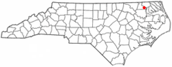 Location of Harrellsville, North Carolina | |
| Coordinates: 36°18′14″N 76°47′24″W / 36.30389°N 76.79000°WCoordinates: 36°18′14″N 76°47′24″W / 36.30389°N 76.79000°W | |
| Country | United States |
| State | North Carolina |
| County | Hertford |
| Area | |
| • Total | 0.3 sq mi (0.9 km2) |
| • Land | 0.3 sq mi (0.9 km2) |
| • Water | 0.0 sq mi (0.0 km2) |
| Elevation | 66 ft (20 m) |
| Population (2010) | |
| • Total | 106 |
| • Density | 307.3/sq mi (118.6/km2) |
| Time zone | Eastern (EST) (UTC-5) |
| • Summer (DST) | EDT (UTC-4) |
| ZIP code | 27942 |
| Area code(s) | 252 |
| FIPS code | 37-29720[1] |
| GNIS feature ID | 0986436[2] |
Harrellsville is a town in Hertford County, North Carolina, United States. The population was 106 at the 2010 census.
Geography
Harrellsville is located at 36°18′14″N 76°47′24″W / 36.30389°N 76.79000°W (36.303895, -76.790083).[3]
According to the United States Census Bureau, the town has a total area of 0.3 square miles (0.78 km2), all of it land.
Demographics
| Historical population | |||
|---|---|---|---|
| Census | Pop. | %± | |
| 1890 | 110 | — | |
| 1900 | 109 | −0.9% | |
| 1910 | 140 | 28.4% | |
| 1920 | 131 | −6.4% | |
| 1930 | 159 | 21.4% | |
| 1940 | 154 | −3.1% | |
| 1950 | 167 | 8.4% | |
| 1960 | 171 | 2.4% | |
| 1970 | 165 | −3.5% | |
| 1980 | 151 | −8.5% | |
| 1990 | 106 | −29.8% | |
| 2000 | 102 | −3.8% | |
| 2010 | 106 | 3.9% | |
| Est. 2015 | 105 | [4] | −0.9% |
As of the census[1] of 2000, there were 102 people, 47 households, and 36 families residing in the town. The population density was 307.3 people per square mile (119.3/km²). There were 50 housing units at an average density of 150.6 per square mile (58.5/km²). The racial makeup of the town was 71.49% White, 21.51% African American, 0.00% Native American, 0.00% Asian, 0.00% Pacific Islander, 0.00% from other races, and 0.00% from two or more races. 0.00% of the population are Hispanic or Latino of any race.
There were 47 households out of which 29.8% had children under the age of 18 living with them, 59.6% were married couples living together, 12.8% had a female householder with no husband present, and 21.3% were non-families. 21.3% of all households were made up of individuals and 14.9% had someone living alone who was 65 years of age or older. The average household size was 2.17 and the average family size was 2.49.
In the town the population was spread out with 19.6% under the age of 18, 28.4% from 25 to 44, 28.4% from 45 to 64, and 23.5% who were 65 years of age or older. The median age was 49 years. For every 100 females there were 100.0 males. For every 100 females age 18 and over, there were 90.7 males.
The median income for a household in the town was $32,000, and the median income for a family was $31,500. Males had a median income of $30,833 versus $30,000 for females. The per capita income for the town was $17,051. None of the population and none of the families were below the poverty line.
History
The town of Harrellsville was founded in the 1820s by the Harrell families. A post office was established in 1827, and Abner Harrell became the postmaster in 1833. Originally known as Bethel, the town was changed to Harrellsville in the 1860s out of respect for Abner Harrell. Originally, Abner Harrell's house, one of the largest buildings in the town, remained standing until about the year 2000, when the land it stood on was purchased and the house torn down.
The Harrellsville Historic District listed on the National Register of Historic Places in 1995.[6]
Notable people
- Robert Holmes Smith (1898–1943) Commander, Squadron 2, U.S. Navy Pacific Submarine Fleet in World War II
References
- 1 2 "American FactFinder". United States Census Bureau. Retrieved 2008-01-31.
- ↑ "US Board on Geographic Names". United States Geological Survey. 2007-10-25. Retrieved 2008-01-31.
- ↑ "US Gazetteer files: 2010, 2000, and 1990". United States Census Bureau. 2011-02-12. Retrieved 2011-04-23.
- ↑ "Annual Estimates of the Resident Population for Incorporated Places: April 1, 2010 to July 1, 2015". Retrieved July 2, 2016.
- ↑ "Census of Population and Housing". Census.gov. Retrieved June 4, 2015.
- ↑ National Park Service (2010-07-09). "National Register Information System". National Register of Historic Places. National Park Service.
External links
Municipalities and communities of Hertford County, North Carolina, United States | ||
|---|---|---|
| Towns |  | |
| Village | ||
| Unincorporated communities |
| |