Haydarpaşa
For the village in Datça, see Datça.
| Haydarpaşa | |
|---|---|
| Neighborhood | |
 Haydarpaşa | |
| Coordinates: TR 41°00′N 29°01′E / 41.000°N 29.017°ECoordinates: TR 41°00′N 29°01′E / 41.000°N 29.017°E | |
| Country |
|
| Region | Marmara |
| Province | Istanbul |
| District | Kadıköy |
| Time zone | EET (UTC+2) |
| • Summer (DST) | EEST (UTC+3) |
| Postal code | 34716 |
| Area code | 0-216 |
Haydarpaşa is a neighborhood within the Kadıköy district on the Asian part of Istanbul, Turkey. The place, on the coast of Sea of Marmara, borders to Harem in the northwest and Kadıköy in the southeast. It is a historical area with almost solely public buildings.
Internationally known structures around the area are the Haydarpaşa Terminal, Port of Haydarpaşa and the Selimiye Barracks in adjacent Harem.
Notable buildings
Following public structures, built in the 19th century or early 20th century during the Ottoman era, are found in Haydarpaşa:
Health and education
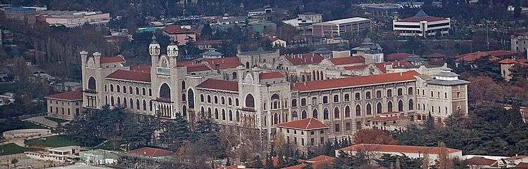
Marmara University's Faculty of Medicine building
- Haydarpaşa Numune Hastanesi (Haydarpaşa Paragon Hospital)[1]
- GATA Haydarpaşa Eğitim Hastanesi (Haydarpaşa Hospital of Gülhane Military Medical Academy)[2]
- Dr Siyami Ersek Hospital — A renowned hospital for cardiology[3]
- Marmara University, Faculty of Medicine, Haydarpaşa Campus. The building was used by Haydarpaşa Lisesi (Haydarpaşa High school) from 1933 through 1983[4]
- Haydarpaşa Technical High schools[5]
Transportation

Haydarpaşa Terminal
- Haydarpaşa Terminal — One of the two main railway terminals of Istanbul serving the railway net in Anatolia[6]
- Port of Haydarpaşa — Biggest container terminal in Istanbul[7]
- Haydarpaşa Ferry boat terminal — Passenger ferries connecting trains to Sirkeci and Karaköy on the European side, and Kadiköy
Religion
- Haydarpaşa Cemetery — Historical British military and civilian cemetery
Vicinity
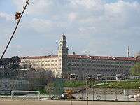
Selimiye Barracks
- Selimiye Barracks — Historical barracks, where Florence Nightingale served between 1854–1856
- Karacaahmet Cemetery — Biggest cemetery in Turkey
References
- ↑ Haydarpaşa Numune Hastanesi (Turkish)
- ↑ GATA Haydarpaşa Eğpitim Hastanesi (Turkish)
- ↑ Medicine Magazine (Turkish)
- ↑ Marmara University (Turkish)
- ↑ Haydarpaşa Teknik Okulları (Turkish)
- ↑ TCDD Turkish State Railways (Turkish)
- ↑ TCDD Haydarpaşa Port
This article is issued from Wikipedia - version of the 12/19/2013. The text is available under the Creative Commons Attribution/Share Alike but additional terms may apply for the media files.