Hazen, Nevada
_June_24%2C_1905.%22_By_Lubkin_-_NARA_-_532037.jpg)

Hazen is an unincorporated community in Churchill County, Nevada, United States, about 12 miles (19 km) southeast of Fernley and 16 miles (26 km) northwest of Fallon, on U.S. Route 50 Alternate.[1]
Hazen was founded in 1903 as a station on the Southern Pacific Railroad.[2] Some sources say the town was first settled in 1869, but it doesn't appear on maps until 1903.[2][3] The community was named for William Babcock Hazen, an aide to William Tecumseh Sherman.[3] At one time Hazen had a post office, which was established in 1904.[2][4] Hazen's early economy was driven by railroad workers and canal and dam builders, who patronized the town's saloons and brothels.[2]
The Hazen Store is listed on the National Register of Historic Places (NRHP).[2] It "almost defies architectural description" according to the NRHP nomination form.[2]
Vulcan Power Company started a permitting process to drill exploratory geothermal energy wells on land leases near Hazen. The project involves a bypass road across Bureau of Reclamation property.[5][6]
The Hawthorne Army Depot is connected to the Union Pacific rail network by a 120-mile (190 km) single rail line beginning in Hazen.[7]

References
- ↑ "Hazen". Geographic Names Information System. United States Geological Survey. November 28, 1980. Retrieved June 18, 2011.
- 1 2 3 4 5 6 "The Hazen Store National Register of Historic Places Registration Form" (PDF). National Park Service. Retrieved June 18, 2011.
- 1 2 Carlson, Helen S. (1974). Nevada Place Names: A Geographical Dictionary. Reno, Nevada: University of Nevada Press. p. 132. ISBN 0-87417-094-X.
- ↑ "Hazen Post Office (historical)". Geographic Names Information System. United States Geological Survey. February 1, 1991. Retrieved June 18, 2011.
- ↑ "Bureau of Reclamation Mid-Pacific Region : NEPA: Patua Bypass Road EA". 29 January 2009. Retrieved 20 June 2011.
- ↑ "ENVIRONMENTAL ASSESSMENT RELEASED ON CONSTRUCTION OF A BYPASS ROAD NEAR HAZEN, NEV.". US Fed News. 12 December 2008.
- ↑ "REID HAILS PASSAGE OF APPROPRIATIONS BILL". States News Service. 19 December 2007.
Coordinates: 39°33′55″N 119°02′47″W / 39.565192°N 119.046273°W
Municipalities and communities of Churchill County, Nevada, United States | ||
|---|---|---|
| City | 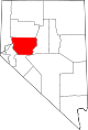 | |
| CDP | ||
| Unincorporated communities | ||
| Indian reservations | ||
| Ghost towns |
| |