Hellendoorn
| Hellendoorn | |||
|---|---|---|---|
| Municipality | |||
|
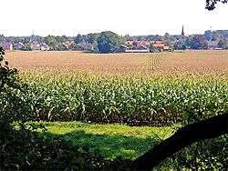
looking toward the Hellendoorn town centre | |||
| |||
.svg.png) Location in Overijssel | |||
| Coordinates: 52°22′N 6°28′E / 52.367°N 6.467°ECoordinates: 52°22′N 6°28′E / 52.367°N 6.467°E | |||
| Country | Netherlands | ||
| Province | Overijssel | ||
| Government[1] | |||
| • Body | Municipal council | ||
| • Mayor | Anneke Raven (CDA) | ||
| Area[2] | |||
| • Total | 138.99 km2 (53.66 sq mi) | ||
| • Land | 138.07 km2 (53.31 sq mi) | ||
| • Water | 0.92 km2 (0.36 sq mi) | ||
| Elevation[3] | 10 m (30 ft) | ||
| Population (May 2014)[4] | |||
| • Total | 35,682 | ||
| • Density | 258/km2 (670/sq mi) | ||
| Time zone | CET (UTC+1) | ||
| • Summer (DST) | CEST (UTC+2) | ||
| Postcode | 7440–7449, 7687–7689 | ||
| Area code | 0546, 0548 | ||
| Website |
www | ||

Hellendoorn (![]() pronunciation ) is a municipality and a town in the middle of the Dutch province of Overijssel.
pronunciation ) is a municipality and a town in the middle of the Dutch province of Overijssel.
There is an amusement park near the town of Hellendoorn called Avonturenpark Hellendoorn.
Population centres
The municipality comprises:
Towns:
- Hellendoorn
- Nijverdal
Hamlets:
- Daarle
- Daarlerveen
- Eelen en Rhaan
- Egede
- Haarle, Hellendoorn
- Hancate
- Hulsen (Overijssel)
- Marle, Hellendoorn
- Noetsele (former hamlet, now an integrated part of Nijverdal)
Topography
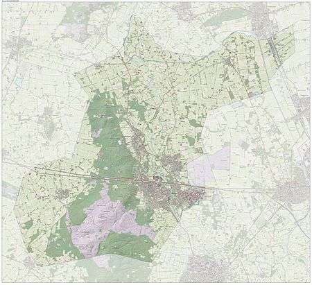
Dutch topographic map of the municipality of Hellendoorn, June 2015
Geography
.jpg)
The central part of the municipality consists of a hilly and sparsely populated area that extends south into the municipality of Rijssen-Holten, called the Sallandse Heuvelrug (Salland Ridge). The highest point lies at about 70 metres (230 ft) above sea level and is part of the Noetselerberg. A large chunk of the area is covered by forest, but there are also heathlands. This scenery is now part of the Sallandse Heuvelrug National Park.
Originally part of the region of Salland, Hellendoorn is now administratively considered part of Twente; a fact reflected in the inclusion of Hellendoorn in the city region of Twente (Kaderwetgebied Regio Twente) as defined by the Dutch government.
History
The municipality of Hellendoorn is the only place in the Netherlands where gold mining took place.
The Germans operated a V-2 launching platform near the town of Hellendoorn during World War II, harassing the city of Antwerp [(Rudi Velthuis - Tracy Dungan - Ed Straten - Cor Lulof (From V2Rocket.com A-4 V-2 Resource site].[5]
On March, 22nd 1945, Nijverdal was severely bombed by allied bombers who were targeting the German Reichskommissar of Austrian origin Arthur Seyss-Inquart. Seyss-Inquart was fleeing the advancing Allied forces and had set up his temporary headquarters in the Reformed School in Nijverdal, but had already left town at the time of the bombing. Over 70 people were killed, mainly at de Grotestraat.
A small part of the film A Bridge Too Far was filmed near Hellendoorn.
In 1955, part of the municipality of Wierden was annexed (Eversberg, Konijnenbelt, Slettenhaar and Lochter) which is the only part of the municipality located on originally Twente soil. In the late-1970s the quarter of 'het Lochter' arose here.
Notable residents
- Herman Ponsteen (born 1953), Dutch track cyclist who won silver at the 1976 Summer Olympics
Gallery
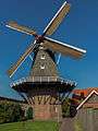 Hellendoorn, windmill: korenmolen de Hoop
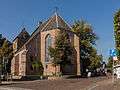 Hellendoorn, church: de Dorpskerk
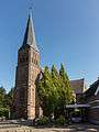 Hellendoorn, church: de Sint Sebastianuskerk
_RM21399_foto8_2014-10-04_12.51.jpg) Hellendoorn, windmill: de Wippe (ook wel de Molen van Fakkert)
Hellendoorn, windmill: de Wippe (ook wel de Molen van Fakkert)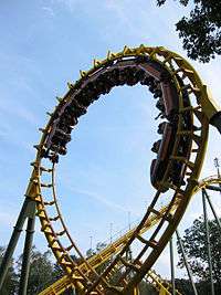 Hellendoorn, Rollercoaster Tornado
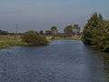 between Hellendoorn and Daarle, river: de Regge
 Daarle, reformed church
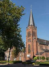 Nijverdal, church: de Antonius van Paduakerk
References
- ↑ "Burgemeester en wethouders" [Mayor and aldermen] (in Dutch). Gemeente Hellendoorn. Retrieved 29 March 2014.
- ↑ "Kerncijfers wijken en buurten" [Key figures for neighbourhoods]. CBS Statline (in Dutch). CBS. 2 July 2013. Retrieved 12 March 2014.
- ↑ "Postcodetool for 7442MA". Actueel Hoogtebestand Nederland (in Dutch). Het Waterschapshuis. Retrieved 29 March 2014.
- ↑ "Bevolkingsontwikkeling; regio per maand" [Population growth; regions per month]. CBS Statline (in Dutch). CBS. 26 June 2014. Retrieved 24 July 2014.
- ↑ SS Werfer Abteilung 500 in Hellendoorn / Dalfsen, Holland Rudi Velthuis - Tracy Dungan - Ed Straten - Cor Lulof (From V2Rocket.com A-4 V-2 Resource site)
External links
| Wikimedia Commons has media related to Hellendoorn. |
 |
Ommen | Twenterand | | |
| Raalte | |
Wierden | ||
| ||||
| | ||||
| Rijssen-Holten |
Municipalities of Overijssel | ||
|---|---|---|
 | ||
| ||