Henry Fork, Virginia
| Henry Fork, Virginia | |
|---|---|
| Census-designated place | |
 Henry Fork  Henry Fork Location within Franklin county | |
| Coordinates: 36°57′53″N 79°52′25″W / 36.96472°N 79.87361°WCoordinates: 36°57′53″N 79°52′25″W / 36.96472°N 79.87361°W | |
| Country | United States |
| State | Virginia |
| County | Franklin |
| Area | |
| • Total | 2.73 sq mi (7.08 km2) |
| • Land | 2.72 sq mi (7.05 km2) |
| • Water | 0.008 sq mi (0.02 km2) |
| Elevation | 1,220 ft (370 m) |
| Population (2010) | |
| • Total | 1,234 |
| • Density | 453/sq mi (175.0/km2) |
| Time zone | Eastern (EST) (UTC-5) |
| • Summer (DST) | EDT (UTC-4) |
| ZIP code | 24151 |
| FIPS code | 51-36445 |
| GNIS feature ID | 2629771 |
Henry Fork is an unincorporated community and census-designated place (CDP) in Franklin County, Virginia, United States, just south of Rocky Mount. The population as of the 2010 census was 1,234.[1]
Geography
The community is in central Franklin County, centered at the junction of the U.S. Route 220 Rocky Mount bypass with U.S. Route 220 Business (South Main Street), 3 miles (5 km) south of the center of Rocky Mount. US 220 leads north 27 miles (43 km) to Roanoke and south 24 miles (39 km) to Martinsville.
According to the U.S. Census Bureau, the Henry Fork CDP has a total area of 2.7 square miles (7.1 km2), of which 0.01 square miles (0.02 km2), or 0.34%, is water.[1] The Pigg River, an east-flowing tributary of the Roanoke River, forms the northern edge of the CDP and its border with Rocky Mount.
References
- 1 2 "Geographic Identifiers: 2010 Demographic Profile Data (G001): Henry Fork CDP, Virginia". U.S. Census Bureau, American Factfinder. Retrieved October 20, 2016.
Municipalities and communities of Franklin County, Virginia, United States | ||
|---|---|---|
| Towns | 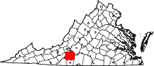 | |
| CDPs | ||
| Unincorporated communities | ||