Herzberg, Ostprignitz-Ruppin
| Herzberg | |
|---|---|
 Herzberg | |
Location of Herzberg within Ostprignitz-Ruppin district _in_OPR.png) | |
| Coordinates: 52°53′59″N 12°58′59″E / 52.89972°N 12.98306°ECoordinates: 52°53′59″N 12°58′59″E / 52.89972°N 12.98306°E | |
| Country | Germany |
| State | Brandenburg |
| District | Ostprignitz-Ruppin |
| Municipal assoc. | Lindow (Mark) |
| Government | |
| • Mayor | Michaela Wolff |
| Area | |
| • Total | 18.57 km2 (7.17 sq mi) |
| Population (2015-12-31)[1] | |
| • Total | 630 |
| • Density | 34/km2 (88/sq mi) |
| Time zone | CET/CEST (UTC+1/+2) |
| Postal codes | 16835 |
| Dialling codes | 033926 |
| Vehicle registration | OPR |
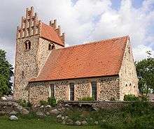
Church
Herzberg is a municipality in the Ostprignitz-Ruppin district, in Brandenburg, Germany.
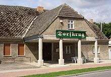
Alcove house
Demography
.pdf.jpg)
Development of population since 1875 within the current boundaries (Blue line: Population; Dotted line: Comparison to population development of Brandenburg state; Grey background: Time of Nazi rule; Red background: Time of communist rule)
|
|
|
|
References
- ↑ "Bevölkerung im Land Brandenburg nach amtsfreien Gemeinden, Ämtern und Gemeinden 31. Dezember 2015 (Fortgeschriebene amtliche Einwohnerzahlen auf Grundlage des Zensus 2011)". Amt für Statistik Berlin-Brandenburg (in German). 2016.
- ↑ Detailed data sources are to be found in the Wikimedia Commons.Population Projection Brandenburg at Wikimedia Commons
Towns and municipalities in Ostprignitz-Ruppin | ||
|---|---|---|
This article is issued from Wikipedia - version of the 7/19/2015. The text is available under the Creative Commons Attribution/Share Alike but additional terms may apply for the media files.