Higashi-Mukō Station
Higashi-Mukō Station 東向日駅 | |
|---|---|
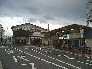 Station building behind bus terminal | |
| Location |
Mukō, Kyoto Japan |
| Operated by | Hankyu Corporation |
| Line(s) | Hankyu Kyoto Main Line |
| Connections |
|
| Other information | |
| Station code | HK-79 |
| History | |
| Opened | November 1, 1928 |
| Previous names | Higashi-Mukōmachi (until 1972) |
| Traffic | |
| Passengers (2013) | 2,998,000 |
Higashi-Mukō Station (東向日駅 Higashi-Mukō-eki) is a train station on the Hankyu Railway Kyoto Line located in Mukō, Kyoto Prefecture, Japan.
Lines
Layout
The station has two side platforms serving two tracks. The platforms are connected each other by an underground passage, which are accessible with slopes elevators. A bus terminal is located outside the East Exit at the south end of Kawaramachi-bound platform. The West Exit is at the south end of Umeda-bound platform.[1]
History
The station opened as Higashi-Mukōmachi Station on November 1, 1928, the day the Shinkeihan Line (present-day Hankyu Kyoto Main Line) was extended from Takatsuki-machi to Kyoto Saiin. On October 1, 1972 when the town of Mukō (Mukō-machi in Japanese) became a city (Mukō-shi in Japanese), the station name was changed to the current one.[2]
Ridership
In fiscal 2013 (April 2013 to March 2014), about 2,998,000 passengers started travel from this station annually. For historical data, see the table below.[3]
| Year | Number (in thousands) |
|---|---|
| 2002 | 3,728 |
| 2003 | 3,697 |
| 2004 | 3,617 |
| 2005 | 3,447 |
| 2006 | 3,377 |
| 2007 | 3,238 |
| 2008 | 3,668 |
| 2009 | 3,305 |
| 2010 | 3,117 |
| 2011 | 2,820 |
| 2012 | 2,913 |
| 2013 | 2,998 |
Stations next to Higashi-Mukō
| « | Service | » | ||
|---|---|---|---|---|
| Hankyu Kyoto Line | ||||
| Commutation Limited Express: Does not stop at this station | ||||
| Limited Express: Does not stop at this station | ||||
| Rapid Express: Does not stop at this station | ||||
| Rapid: Does not stop at this station | ||||
| Nishi-Mukō | Semi-Express | Rakusaiguchi | ||
| Nishi-Mukō | Local | Rakusaiguchi | ||
References
External links
- Higashi-Mukō Station from Hankyu Railway website (Japanese)
Coordinates: 34°57′12″N 135°42′14″E / 34.9534°N 135.7039°E