Highland County Airport
| Highland County Airport | |||||||||||
|---|---|---|---|---|---|---|---|---|---|---|---|
| IATA: none – ICAO: KHOC – FAA LID: HOC | |||||||||||
| Summary | |||||||||||
| Airport type | Public | ||||||||||
| Owner | Highland County Commissioners | ||||||||||
| Serves | Hillsboro, Ohio | ||||||||||
| Elevation AMSL | 977 ft / 298 m | ||||||||||
| Coordinates | 39°11′19″N 083°32′19″W / 39.18861°N 83.53861°W | ||||||||||
| Map | |||||||||||
 HOC  HOC Location of airport in Ohio/United States | |||||||||||
| Runways | |||||||||||
| |||||||||||
| Statistics (2009) | |||||||||||
| |||||||||||
Highland County Airport (ICAO: KHOC, FAA LID: HOC) is a public-owned, public-use airport located at 9500 North Shore Drive three nautical mile (4.8 km) southeast of the central business district of the city of Hillsboro, in Highland County, Ohio, United States.[1]
Although many U.S. airports use the same three-letter location identifier for the FAA and IATA, this airport is assigned HOC by the FAA but has no designation from the IATA[2] (which assigned HOC to Komako Airport in Komako, Papua New Guinea[3]).
Gallery
-
Main office terminal
-

Airplane hangars
-

Hangar 6 Inc.
-

Hangar 6 Inc.
-

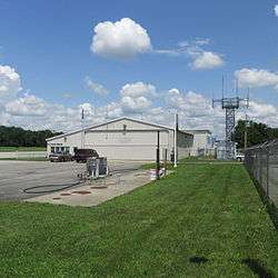
Security building
Facilities and aircraft
Highland County Airport covers an area of 15 acres (6.1 ha) at an elevation of 977 feet (298 m) above mean sea level. It has one asphalt paved runway: 05/23 is 3,520 by 75 feet (1,073 x 23 m).[1]
For the 12-month period ending May 22, 2009, the airport had 13,870 aircraft operations, an average of about 267 per week: 97% general aviation, 2% military, and 1% air taxi. At that time there were 21 aircraft based at this airport: 90% single-engine, 5% multi-engine, and 5% helicopter.[1]
References
- 1 2 3 4 FAA Airport Master Record for HOC (Form 5010 PDF), effective 2009-05-22.
- ↑ "Highland County Airport (ICAO: KHOC, FAA: HOC)". Great Circle Mapper. Retrieved 29 May 2010.
- ↑ "Komako Airport HOC (IATA: HOC)". Great Circle Mapper. Retrieved 29 May 2010.
External links
- FAA Terminal Procedures for HOC, effective November 10, 2016
- Resources for this airport:
- FAA airport information for HOC
- AirNav airport information for HOC
- FlightAware airport information and live flight tracker
- SkyVector aeronautical chart for HOC