Hill Top, McCreary County, Kentucky
| Hill Top, Kentucky | |
|---|---|
| Unincorporated community | |
 Hill Top, Kentucky | |
| Coordinates: 36°43′21″N 84°32′00″W / 36.72250°N 84.53333°WCoordinates: 36°43′21″N 84°32′00″W / 36.72250°N 84.53333°W | |
| Country | United States |
| State | Kentucky |
| County | McCreary |
| Elevation | 1,217 ft (371 m) |
| Time zone | Eastern (EST) (UTC-5) |
| • Summer (DST) | EDT (UTC-4) |
| Area code(s) | 606 |
| GNIS feature ID | 512709[1] |
Hill Top is an unincorporated community in McCreary County, Kentucky, United States. Hill Top is located on Kentucky Route 92 near the Big South Fork of the Cumberland River, 3.5 miles (5.6 km) west of Whitley City.[2]
A post office was established in the community in 1925, and named for its scenic overlooks.[3]
References
- ↑ "Hill Top". Geographic Names Information System. United States Geological Survey.
- ↑ State Primary Road System: McCreary County (PDF) (Map). Kentucky Transportation Cabinet. 2012. Retrieved June 28, 2012.
- ↑ Rennick, Robert M. (1987). Kentucky Place Names. University Press of Kentucky. p. 141. Retrieved 2013-04-28.
Municipalities and communities of McCreary County, Kentucky, United States | ||
|---|---|---|
| CDPs | 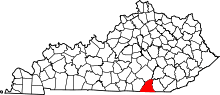 | |
| Unincorporated communities | ||
This article is issued from Wikipedia - version of the 10/11/2016. The text is available under the Creative Commons Attribution/Share Alike but additional terms may apply for the media files.