Hokitika River
| Hokitika River | |
|---|---|
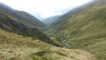
 Hokitika River with Southern Alps in the background | |
| Country | New Zealand |
| Basin | |
| Main source | Southern Alps |
| River mouth | Tasman Sea |
| Physical characteristics | |
| Length | 64 kilometres (40 mi) |
The Hokitika River is in the West Coast of the South Island of New Zealand. It is about 64 kilometers (40 mi) long, beginning in the Southern Alps, emerging from the narrow Hokitika Gorge after merging with the Whitcombe River, and flowing into the Tasman Sea just south of the town of Hokitika.
The Hokitika River, and its eastern tributary, the Kokatahi River, have formed the Kowhitirangi-Kokatahi alluvial plain; a fertile and productive land extensively used for dairy farming.
The entrance to the Hokitika River was once used as a harbour during the West Coast's gold rush; however, the sand bar at the river mouth created a treacherous and often fatal obstacle - resulting in many shipwrecks. After the gold-rush subsided, the use of the river as a harbour declined and is now no longer used.
References
External links
| Wikimedia Commons has media related to Hokitika River. |
Coordinates: 42°43′S 170°57′E / 42.717°S 170.950°E