Holmesfield
| Holmesfield | |
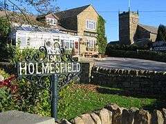 Holmesfield parish church and The Angel public house |
|
 Holmesfield |
|
| Population | 971 (2011) |
|---|---|
| OS grid reference | SK322776 |
| District | North East Derbyshire |
| Shire county | Derbyshire |
| Region | East Midlands |
| Country | England |
| Sovereign state | United Kingdom |
| Post town | DRONFIELD |
| Postcode district | S18 |
| Police | Derbyshire |
| Fire | Derbyshire |
| Ambulance | East Midlands |
| EU Parliament | East Midlands |
| UK Parliament | North East Derbyshire |
|
|
Coordinates: 53°17′42″N 1°31′05″W / 53.295°N 1.518°W
Holmesfield is a village and civil parish in the English county of Derbyshire. The population of the civil parish at the 2011 Cenus was 973.[1] The name "Holmesfield" means "raised pasture-land" and is of Norse and Anglo-Saxon origin. Viking influences are also evident with many road names suffixed by "gate", the old Norse word for "way".
History
Holmesfield is mentioned in the Domesday Book as one of the manors belonging to Walter D'Aincourt.[2]
John Frescheville, 1st Baron Frescheville, was in 1645 ordered to pay an annuity to the Vicar of Holmesfield Church, as part his fine, for being on the losing side in the civil war.
St Swithins parish church can be seen from much of the surrounding area. The main church was built in 1826 but has seen further work in recent years with the vicarage being added in 1999. Still visible in the grounds are the remains of a stone cross from around 641 AD, which would have replaced an original wooden cross erected by monks to mark the place where they would preach. Other notable buildings in the village include Holmesfield Hall, dated 1613, with additions built in the 18th century, and Woodthorpe Hall, a large 17th-century, gabled manor house, dating back to 1636.
Geography
Holmesfield is sited at approximately 800 feet (240 m) above sea level on the edge of the Peak District National Park, with extensive views from the village over the surrounding hilly terrain. The village includes a number of farming hamlets such as Millthorpe situated in the neighbouring Cordwell Valley.
Notable buildings
Within Holmesfield civil parish there are 43 structures that are listed by Historic England for their historic or architectural interest. None is listed as Grade I but there are five structures (Cartledge Hall, Holmesfield Hall, Unthank Hall, farm outbuildings east of Holmesfield Hall, and an outbuilding southwest of Unthank Hall) that are listed as Grade II*. The other structures are listed as Grade II.[3]
Notable residents
- Edward Carpenter, socialist and poet, lived at Millthorpe.[4]
- Robert Murray Gilchrist, novelist, lived and died at Cartledge Hall, buried in the parish churchyard.[5]
Amenities
Holmesfield is well-provided with amenities, including a village hall, a riding school, a Victorian built primary school[6] and three public houses (The Rutland Arms, The George and Dragon, and The Angel).
References
- ↑ "Civil Parish population 2011". Neighbourhood Statistics. Office for National Statistics. Retrieved 26 March 2016.
- ↑ Domesday Book: A Complete Translation. London: Penguin, 2003. p.750 ISBN 0-14-143994-7
- ↑ "Listed Buildings in Holmesfield, Derbyshire, England". britishlistedbuildings.co.uk. Retrieved 27 November 2016.
- ↑ Mee, Arthur (1969). Derbyshire. The King's England (2 ed.). Hodder and Stoughton. p. 135.
- ↑ Mee, Arthur (1969). Derbyshire. The King's England (2 ed.). Hodder and Stoughton. p. 135.
- ↑ Pennyacres
External links
- Holmesfield in the Domesday Book
 Media related to Holmesfield at Wikimedia Commons