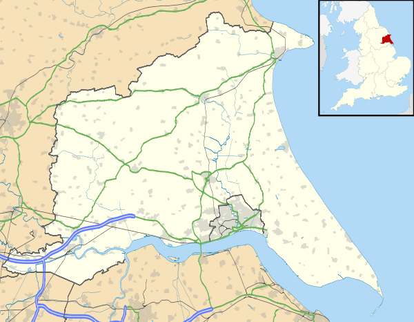
Holmpton
| Holmpton | |
 Holmpton village |
|
 Holmpton |
|
| Population | 228 (2011 census)[1] |
|---|---|
| OS grid reference | TA366234 |
| – London | 150 mi (240 km) S |
| Civil parish | Holmpton |
| Unitary authority | East Riding of Yorkshire |
| Ceremonial county | East Riding of Yorkshire |
| Region | Yorkshire and the Humber |
| Country | England |
| Sovereign state | United Kingdom |
| Post town | WITHERNSEA |
| Postcode district | HU19 |
| Dialling code | 01964 |
| Police | Humberside |
| Fire | Humberside |
| Ambulance | Yorkshire |
| EU Parliament | Yorkshire and the Humber |
| UK Parliament | Beverley and Holderness |
Coordinates: 53°41′23″N 0°04′05″E / 53.689636°N 0.068052°E
Holmpton is a village and civil parish in the East Riding of Yorkshire, England, in an area known as Holderness. It is situated approximately 3 miles (5 km) south of Withernsea town centre and 3 miles east of the village of Patrington. It lies just inland from the North Sea coast.
According to the 2011 UK Census, Holmpton parish had a population of 228,[1] an increase on the 2001 UK Census figure of 193.[2]
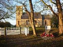
The parish church of St Nicholas is a Grade II listed building.[3]
The Greenwich Prime Zero meridian line passes through the parish.
In 1823 Holmpton was a parish in the Wapentake of Holderness. The patronage of the parish church was under the King. Population at the time was 256. Occupations included eight farmers, two wheelwrights, a blacksmith, two tailors, a milliner, a shoemaker, a shopkeeper, and the landlord of The Board public house. There was also a schoolmaster, a curate, and a gentleman. A carrier operated between the village and Hull twice weekly.[4]
RAF Holmpton
The village is home to RAF Holmpton, built originally as an early warning radar station, and now refurbished to act as museum and archive.
Royal Air Force Holmpton is still a part of the RAF and the Defence Estate (2009). It currently hosts a Public Exhibition [5] and is also home to the Defence Archives Unit. RAF Holmpton is managed by HIPPO an Independent Finance Initiative. The site runs to about 36 acres (15 ha) and comprises a number of surface structures along with a secure 35,000 square feet (0.33 ha) command bunker which is about 100 feet (30 m) below ground.
The bunker was first built in 1951–3 and started life as an early Warning Station (part of the ROTOR programme). In the late 1960s it became a Master Comprehensive Radar Station which eventually closed in 1974. The used for training the site was converted in the 1980s to form the new War HQ for RAF Support Command. With the ending of the Cold War this function ceased in 1991 and the site returned to training until the 1990s when it was rebuilt to become the 1st experimental HQ of the new CCIS Electronic Warfare System. This function left the site in 2000–01. In 2003 Defence Archives moved to the site and in 2004 the first public exhibition opened. The exhibition opens throughout the year to visitors and 75% of the bunker is included in the visit, apart from AREA 7 which remains classified.[6]
Second World War
On 14 January 1942 at 20.44 a Royal Air Force Avro Manchester bomber crashed on Mill Hill south of the village of Holmpton. The plane was seen with the port engine on fire with flames extending back past the tail. It struck the hill and exploded on impact killing all seven crew members on board.
The plane was Avro Manchester L7523 EM:M of No. 207 Squadron RAF stationed at RAF Bottesford in Leicestershire. It had been charged with attacking the Blohm and Voss shipyards in Hamburg. The plane was delayed on take-off due to an unknown technical issue and eventually headed for the North Sea some time behind the rest of the squadron. The time of flight and speed of the Manchester doesn't allow the aircraft to have reached Hamburg and it is most likely to have reached the Dutch Frisian Islands before returning home, either hit by the enemy or very likely a mechanical failure which was common with the Avro Manchester.
A memorial to the crew of the aircraft was dedicated in November 2009 in the grounds of St Nicholas church in Holmpton.[7]
References
- 1 2 "Key Figures for 2011 Census: Key Statistics: Area: Holmpton CP (Parish)". Neighbourhood Statistics. Office for National Statistics. Retrieved 5 February 2013.
- ↑ "2001 Census: Key Statistics: Parish Headcounts: Area: Holmpton CP (Parish)". Neighbourhood Statistics. Office for National Statistics. Retrieved 17 May 2008.
- ↑ Historic England. "Church of St Nicholas (1083482)". National Heritage List for England. Retrieved 5 February 2013.
- ↑ Baines, Edward (1823): History, Directory and Gazetteer of the County of York, p. 219
- ↑
- ↑ Information provided by HIPPO at RAF Holmpton 2009.
- ↑ Welton, Mike (November 2009). "Memorial Dedication at Holmpton". The Spurn, Kilnsea and Easington Area Local Studies Group. Retrieved 27 July 2011.
- Gazetteer — A–Z of Towns Villages and Hamlets. East Riding of Yorkshire Council. 2006. p. 7.
External links
 Media related to Holmpton at Wikimedia Commons
- Historic England. "St Nicholas' Church (166559)". Images of England.
- RAF Holmpton Official website
- Holmpton in the Domesday Book