Hoskote
| Hoskote ಹೊಸಕೋಟೆ | |
|---|---|
| city | |
 Hoskote Location in Karnataka, India | |
| Coordinates: 13°04′N 77°48′E / 13.07°N 77.8°ECoordinates: 13°04′N 77°48′E / 13.07°N 77.8°E | |
| Country |
|
| State | Karnataka |
| District | Bangalore Rural |
| Elevation | 891 m (2,923 ft) |
| Population (2011) | |
| • Total | 56,980 |
| Languages | |
| • Official | Kannada |
| Time zone | IST (UTC+5:30) |
| PIN | 562114 |
| Telephone code | 91-80 |
| Vehicle registration | KA-53 |
Hoskote is a taluk in Bangalore Rural District. Headquartered at the Hoskote town, it consists of five hoblis - Anugondanahalli, Jadigenahalli, Kasaba, Nandagudi and Sulibele. Agriculture, apiculture and horticulture are primary occupations of people here, although the industrialization in the recent times in Hoskote and places around has thrown up new opportunities for the people. Hoskote is the largest taluk in Karnataka having 333 villages.
Hoskote town is the headquarters of the Hoskote Taluk, and lies at the intersection of NH-4 and NH-207 and as such is a busy town with both resident and floating population. Hoskote has a medical college and research institute known as MVJ Medical College & Research Centre.
Hoskote is known for its moderate climate throughout the year. The town is around 900 m above sea level making its climate usually 1 or 2 degrees cooler than Bangalore.
History
Hoskote, 25 km from Bangalore was a pre-historic centre. According to a copper plate grant dated 1494, given to a Veerashiva Matha the place was founded by Thamme Gowda, the chief of Sugatur. The place is also noted for a large tank with an embankment which is two miles long, and when full, forms a sheet of water not less than 12 km in circumference. Thammegowda is said to have constructed this tank and by raising an armed force, he annexed places like Anekal, Mulbagal and Punganur (A.P.). His successors ruled till 1638.. Shortly after, the territory was conquered by the Bijapur army and subsequently conferred as a Jahgir on Shahaji, who resided at Bangalore. He had an officer called Yeshwantrao posted here. On the capture of these districts by the Mughal army under Khasim Khan in 1687, they became part of the Sira Province. In 1756, Hoskote was taken by the Mysore army, but was subdued by the Marathas (Peshwa). It changed hands several times until it was finally annexed by Haider Ali in 1761.
The old fort area has the Avimukteshwara, Varadaraja and the Vithoba temples. The Avimukteshwara is a very large Dravidian structure ascribed to Thammegowda, the chief of Sugatur. It has three cells in a line, the middle cell enshrining a figure of Virabhadra, the one to the right Shivalinga and other to the left Parvati. There is an oblong Ardhamantapa with its entrance having Dwarapalakas. There is a spacious Navaranga with rows and rows of Vijayanagar pillars having very interesting reliefs sculptures depicting Shaiva episodes. Inside the Navaranga are placed impressive sculptures of Ganapati (two handed) and Subrhamanya (with two hands) having early Vijayanagara features. In front of the temple is a fine Dipasthambha, about 7.5 metres tall with a circular pedestal. It is in the Maratha style. On a pillar to the left of the Mukhamantapa is carved a standing figure of a Bhakta, described as representing the chief Thamme Gowda. A similar figure is also seen on one of the pillars of the Kalyana Mantapa. Behind the temple (outside) was an ashmound and many stone tools had been located. Other temples of the place are Varadaraja, Anjaneya (two), Vithala (Panduranga), Kashi Vishveshwara, Sri Rama etc. The Varadaraja temple has two Garbhagrihas, with the central one having a standing image of late Vijayanagara workmanship and the left cell has the seated image of Devi. The pillars of the Navaranga are in Vijayanagar style (renovated) and have many relief sculptures. It has been said that the temple was renovated around 1830 by the then Tahsildar Biligiri Rao. He is also said to have built the Anjaneya temple (also called Agrahara Anjaneya) near the tank sluice. Another Anjaneya temple in the fort area has a tall image in profile, about one metre height. An unpublished Tamil record is seen near this (pete Anjaneya) temple. This temple which appears to have been renovated rcently has a Navaranga having four beautifully carved black stone pillars. It is said that they originally belong to an old Shiva temple of Dravidian style. Some of the relief sculptures here depicting Shiva Purana episodes are of fine quality. Among the interesting are a huntress armed, with bow and arrow removing a thorn from one of the legs, Tandaveshvara with Vishnu as a drummer and Brahma and Subrahmanya as attendant musicians, Narasimha as a drummer, Bedara Kannappa, Yama seizing Markandeya, Bhikshatana Shiva resting his right hand on a basket borne on the head of a dwarf and receiving alms from a woman, etc.
The Vithala (Panduranga) temple also has three cells in a row and the central cell has a good image of Vithala about one metre tall, flanked by consorts. Two pillars in the temple are in Vijayanagara style. The deity stands with his two hands placed on the waist. The right cell has figures of Garuda and Ganapathi and the left a figure of Hanuman. The main gate of the fort itself appears to have been used as entrance to the temple, and touching this entrance are remains of fortification. From the records in the possession of the priest of the Vithalaswamy temple, we learn that it was built around the middle of the 17th century by Raghunath Bhavji, Subedar of Hoskote Paragana at the instance of the Peshwa. The village Turugalur (Malur tq) has been granted to the deity as per this record. The place has two Veerashaiva Mathas called Mahantaiah Matha (also called Chilume Matha) and Virattayya Matha. The last mentioned is about 1.5 km outside the town. The former is called `Chilume' as it has a perennial spring in the form of well which supplies good drinking water to a portion of the town. The Virattayya Matha is a large building with several sculptured pillars and it is also said to have been constructed by Tammegowda.
Behind the Matha is a fine well faced with dressed stone slabs on all sides. In a private garden are a few Masti-stones which differ in some respects from all other such stones in other parts of the old Mysore area. One of them shows a male figure armed with daggers in both hands, the right hand being raised; while a female holds in her left hand a water vessel and the right hand placed on the belly. In the municipal garden is a small building, where many sculptures like a number of Nandis, images of Vishnu, Virabhadra, Ganapati, a Saptamatrika panel, one Masti stone, etc. are preserved. The town also has shrines of Nagareshwara, Maravva, Venugopala, Kalamma (old) etc.The annual Karaga and the Avimukteshwara Jatra are held in April–May (Chaitra-Poornima) when more than 10,000 people gather. There are four mosques in the town. In a private garden near the fort is a Dargah ascribed to Saballi Sab Ali Sab, who is said to have lived about 200 years ago. The Urus here is held during Ramzan. Near this, across the field is a small Hanuman temple with Vijayanagara pillars, and names of many devotees are engraved on them such as Appaji, Muddamma, Gopali, Chikkamuddappa, Nagisetti, Ballappa, etc. There is also an old temple tank here. Another Dargah situated near the old mosque in the town is ascribed to Sailab Ali Shah and the Urus is held in the month of Bakrid.
In modern history, Hoskote finds mention as the site of the Battle of Ooscota (22 August 1768) during the First Anglo-Mysore War.[1]
Connectivity
Lying on NH 4, and about 27 km from Bangalore City, Hoskote is well connected to Bangalore by buses (BMTC as well as KSRTC buses). The nearest railway stations to Hoskote are the Krishnarajapuram and Whitefield railway stations & also there is a railway station coming up in Hoskote town under Whitefeild-Kolar new railway line (52 km) in future & we can travel by train from Hoskote to Bangalore city & to Kolar also which connects Tavarekere station & Narsapura station coming up & this new railway line which they are going to construct in future officially belongs to Bangalore Suburban Railways (Bangalore Local Commuter Rail). It is close to the border with Tamil Nadu and Andhra Pradesh, where Hosur is 52 km away via under NH 207 & 49 km away via Malur-Hosur road & 51 km away via Sarjapura-Attibele road which also connects to NH 207 nearby and Madanapalle is 103 km away and Palamner is 114 km away and Punganur is 111 km away and Kuppam is 100 km via Kolar, Bangarpet, KGF & 92 km via Malur, Masti & 93 km via Malur, Bangarpet, KGF.
Demographics
As of 2011 India census,[2] Hoskote had a population of 56980. Males constitute 52% of the population and females 48%. Hoskote has an average literacy rate of 86.22%, higher than the state average of 75.36%: male literacy is 89.58%, and female literacy is 82.68%. Hoskote has 11.98% of its population under 6 years of age.
Trivia and places of interest
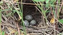
- Hoskote is a destination for birdwatchers and parasailers (the dried lake-bed is used for the purpose). Villages with rustic views around Hoskote are a treat for photographers.
- The annual Karaga and the Avimukteshwara Jatre are held in April–May (Vishaka-Buddha Poornima) when more than 10,000 people gather
- Avimukteshwara, Varadaraja and the Vithoba temples in the old fort area
- Kote Anjaneyaswamy temple which is about 800 years old.
- The town also has shrines of Nagather pet Kashi vishweshwar (Nagareshwar), Kashivishweswer & PrasanaRameshwar, Sri Raghavendra swamy Matta at Brahaman Street, Maravva and Venugopala. Other temples include the popular Saibaba Mandir and the Panchamukhi Vinayaka,Makanahalli kateramma Devi Temple.
- There are four mosques in the town. In a private garden near the fort is a Dargah ascribed to Saballi Sab Ali Sab, who is said to have lived about 200 years ago.
- Hoskote Mission of Mar Thoma church is one of the oldest Christian Mission organization in this area, which was started in 1946.Now there is a Mission Hospital, Nursing College, Old Age Home etc. run by Hoskote Mission. Rev. James M Koshy Veeramala is the present director
- Other places to visit close by are Kaiwara ( Chintamani Taluk, 40 km from Hoskote on the Chintamani road), Shivarapatna ( Malur Taluk, known for its rich culture of sculptors and sculpting ) and Chikkatirupathi ( 27 km, a famous temple dedicated to Lord Venkateswara, a mini replica of the famous temple in Thirumala )
- The Dhrupadamma Karaga is known to have been started by early residents of Hoskote, even perhaps before Bangalore Karaga. Vannikula religion people celebrate this festival in a grand manner.
- Mutkhur is one of the famous holy place in Hoskote, Because 101 temples are there but now only few are there.
Institutions
- Research Institute
- Indian Institute of Astrophysics
- Colleges
- Hoskote Mission Institute of Nursing
- MVJ Medical college & Research centre
- MVJ Nursing college, Hoskote
- Bhilhara Nursing college
- Lakshmi devi Nursing college
- Al-Ameen college
- Govt. PU Girls & Boys college
- Govt. Degree college
- RCNC Education trust
- Rajiv Gandhi Institute of petroleum technology
- Schools
- ST Joseph's English High school
- Sri Vivekananda Vidhya Kendra, Hosakote
- Bright School (oldest English medium school in town & taluk)
- Eurokids international Hoskote
- Montreal English school
- Vivekananda High School, Sulebele
- Sri Gayathri Vidya Mandira
- Government High School
- Bharatha Matha school
- Morarji Desai Residential School Sulibele
- Rajalakshmi ITI, Near GEF Eye hospital
- GS ITI, Near Govt PU College
- Global Education institutions, Industrial Area Hoskote
- Capstone High School
Caldwell Academy, Hoskote
- Navya vidya samsthe, anugondnahalli,
- Citizens High School, Hoskote
- Uzma English School, Hoskote
- Om Shree Public School, Hoskote
- Sharanya Narayani International School
- Delhi public School whitefield, Mallasandra
- Medhasree olympiad School & Sri Sai PU college Hoskote
References
| Wikimedia Commons has media related to Hoskote Lake. |
- ↑ First Anglo-Mysore War
- ↑ "Census of India 2011: Data from the 2011 Census, including cities, villages and towns (Provisional)". Census Commission of India. Archived from the original on 2004-06-16. Retrieved 2008-11-01.