Injuwarampur
| Injuwarampur, Kanpur Dehat district Enjuva Rampur | |
|---|---|
| Village | |
| Nickname(s): Injua | |
 Injuwarampur, Kanpur Dehat district  Injuwarampur, Kanpur Dehat district Location in Uttar Pradesh, India | |
| Coordinates: 26°47′52″N 79°54′30″E / 26.79778°N 79.90833°ECoordinates: 26°47′52″N 79°54′30″E / 26.79778°N 79.90833°E | |
| Country | India |
| State | Uttar Pradesh |
| District | Kanpur Dehat |
| Population (2001[1]) | |
| • Total | 1,221 |
| Languages | |
| • Official | Hindi |
| Time zone | IST (UTC+5:30) |
| Vehicle registration | UP-77 |
| Coastline | 0 kilometres (0 mi) |
Injuwarampur is a village in Kanpur Dehat district in the state of Uttar Pradesh, India.
It is located in Derapur tehsil and near to Rura town at a distance of 7 kilometres. Post office, primary school and upper primary school[2] are here in government sector.
Transport
Ambiyapur is a nearest railway station of the village at a distance 2 km west-north. It falls on the Agra-Kanpur Railway Route North Central Railway zone. Rura Railway Station (9 km) is the nearest railway station to east and to the west Jhinjhak is at a distance of 10 km. Kanpur Central railway station is the nearest major Railway station.
- Available Trains
- 64162 Shikohabad-Kanpur Pass
- 51810 Tundla-Kanpur Pass
- 64156 Tundla -Kanpur Pass
- 64158 Kanpur-Tundla Pass
- 51809 Kanpur-Tundla Pass
- 64159 Kanpur-Shikohabad Pass
It is connected with link road to Bhatauli-Rura town, Rura city, Derapur town, Kanpur via Akbarpur and to the Golden Quadrilateral National Highway of India.
Nearest town
Rura is 7 km east, Bhatauli-Rura is 7 km east, Jhinjhak 13 km west, and Derapur is south at a distance of 15 km.
Administration
The village administrated by Pradhan who is an elected representative of village as per constitution of India and Panchayati Raj India.
List of Gram Pradhan
- Ram Khelawan Mishra (1952---)
- Manni Singh Gaur
- Raja Ram Trivedi
- Indra Pal Singh Gaur
- Dulare Lal Savita
- Harpal Singh Kushwah
- Gyan Wati
- Vimla Devi
- Rajesh Singh Gaur
- BriJ Mohan Trivedi
- Geeta Devi (2015--- till date) [3]
Festivals
All national festivals, Holi, Diwali, Mahashivratri, Shri Krishna Janmashtami, Ramnavami, Makara Sankranti, Eid-ul-Fitr, Rakshabandhan, Hanuman jayanti and other local ones such as Nag-Panchmi, Navratri, Durga Puja are celebrated with enthusiasm.
Visiting Places
- Shiv Temple: It is about 200 years old and is constructed by renowned katyayan gotriya Mishra family. Shiv Ling is main grave image at center of temple on a plateform and adjacent is sitting Nandi. Ganesh, Parwati and kartikey are placed on walls chambers.Main festival is celebrated on Maha Shivratri.
 Shiv Temple - Injuwarampur
 - Hanuman temple: under Peepal tree. This temple is made 25 years ago but graved image is about 200 years old.
- Hardol ka mandir: This temple is special type temple and is rare for its quality. Every new married spouse first go to this temple for blessings.
It is situated near upper primary school towards south of township.
.jpg)
Demographics
As of 2001 India census, Injuwarampur had a population of 1221. Males constitute 51% of the population and females 49%.
Geography
Injuwarampur is located at 26°47′52″N 79°54′30″E / 26.79778°N 79.90833°E. Station name: Ambiyapur, Station code: APP
Gallery
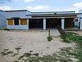 Primary School Injuwarampur
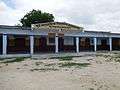 Junior High School, Injuwarampur
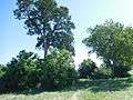 Misiran garden
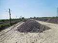 Railway Corridor