Interstate 10 in Alabama
| ||||
|---|---|---|---|---|
_map.svg.png) | ||||
| Route information | ||||
| Maintained by ALDOT | ||||
| Length: | 66.269 mi[1] (106.650 km) | |||
| Major junctions | ||||
| West end: |
| |||
| East end: |
| |||
| Location | ||||
| Counties: | Mobile, Baldwin | |||
| Highway system | ||||
| ||||
.svg.png)
Interstate 10 (I-10) is a part of the Interstate Highway System that runs from Santa Monica, California, to Jacksonville, Florida. In Alabama, the Interstate Highway runs 66.269 miles (106.650 km) from the Mississippi state line near Grand Bay east to the Florida state line at the Perdido River. I-10 is the primary east–west highway of the Gulf Coast region of Alabama. The highway connects Mobile, the largest city in South Alabama, with Pascagoula, Mississippi, to the west and Pensacola, Florida, to the east. Within the state, the highway connects Mobile and Mobile County with the Baldwin County communities of Daphne and Fairhope. I-10 connects Mobile and Baldwin County by crossing the northern end of Mobile Bay and the southern end of the Mobile-Tensaw River Delta via the George Wallace Tunnel in Mobile and the Jubilee Parkway viaduct system between Mobile and Daphne.
Route description
I-10 enters Mobile County from Jackson County, Mississippi, near just north of where US-90 crosses the state line near Grand Bay. The four-lane freeway has an eastbound welcome center ahead of its first interchange, a diamond interchange with the western end of Alabama State Route 188 (SR-188) due north of the center of Grand Bay. I-10 continues east-north-east through a partial cloverleaf interchange with County Road 39 (CR-39) north of Irvington. The highway crosses the Fowl River and curves more northeast through a diamond interchange with CR-30 (Theodore Dawes Road) west of the community of Theodore. I-10 expands to six lanes ahead of a pair of interchanges near Tillmans Corner: a partial cloverleaf interchange with US-90 (Government Boulevard) and a full cloverleaf interchange with SR-193 (Rangeline Road).[2]
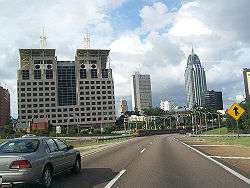
I-10 enters the city of Mobile at Halls Mill Creek just east of SR-193. The highway has a directional-T interchange with the southern end of I-65, which serves Montgomery and Birmingham. I-10 continues northeast from I-65 as an eight-lane freeway that parallels CSX's NO&M Subdivision rail line. The highway has a complex interchange with SR-163 (Dauphin Island Parkway) just east of the Dog River; the interchange includes a flyover from southbound SR-163 to eastbound I-10 and a left-ramp flyover from westbound I-10 to southbound SR-163. I-10 and the railroad form the northern margin of Mobile Aeroplex at Brookley (formerly Brookley Air Force Base), along which the freeway has a partial cloverleaf interchange with Michigan Avenue. North of the airport, the Interstate has a pair of half-diamond interchanges with Duval Street and Broad Street; the half-interchanges are connected by a one-way pair of frontage roads.[2]
I-10 crosses over a Canadian National Railway/Illinois Central Railroad rail line and leaves the CSX rail line as it curves north toward downtown Mobile. The freeway has a four-ramp partial cloverleaf junction with Virginia Street and a pair of half-diamond interchanges with Texas Street (southbound exit, northbound entrance) and Canal Street (northbound exit, southbound exit). North of Canal Street, I-10 has a directional-T interchange with Water Street, which provides access to downtown Mobile. Within that interchange, the freeway reduces to four lanes and curves east and descends into the George Wallace Tunnel to pass under the Mobile River. I-10 resurfaces on Blakeley Island and has an interchange with US-90 and US-98 (Battleship Parkway) west of Battleship Memorial Park.[2]
I-10 leaves Blakeley Island, the city of Mobile, and Mobile County on Jubilee Parkway, a dual-viaduct crossing of several rivers at the northern end of Mobile Bay. The first major segment is a crossing of Polecat Bay, and the confluence of the Spanish River and the Tensaw River, within which the Interstate enters Baldwin County. The viaduct continues through a cut in an island, then continues across Chacaloochee Bay, within which the freeway has a diamond interchange with US-90 and US-98 (Battleship Parkway), which mostly follow causeways across the great expanse of water. Beyond the interchange, I-90 continues across the bay and the mouth of the Apalachee River, Bay John, the mouth of the Blakeley River, and D'Olive Bay. The dual viaducts reach the eastern shore just west of a five-ramp partial cloverleaf interchange with US-90 and US-98 south of the center of Spanish Fort and north of Fairhope.[2]
I-10 continues east as a four-lane freeway along the northern edge of the city of Daphne. The freeway has a diamond interchange with SR-181 (Malbis Plantation Parkway) in the northeastern corner of the city near the hamlet of Malbis. I-10 has a four-ramp partial cloverleaf interchange with SR-59 on the northern edge of Loxley. The Interstate crosses the Fish River and has a diamond interchange with the Baldwin Beach Express, a new county highway that connects I-10 with the beach communities of Gulf Shores and Orange Beach. I-10 has one more interchange in Alabama, a diamond interchange with CR-64 (Wilcox Road). Beyond CR-64, the freeway parallels and then crosses the Styx River, then the westbound highway has a welcome center just west of the Perdido River, where I-10 leaves Alabama and enters Escambia County, Florida, northwest of Pensacola.[2]
Exit list
| County | Location | mi[1][2] | km | Exit | Destinations | Notes |
|---|---|---|---|---|---|---|
| Mobile | Grand Bay | 0.000 | 0.000 | — | Western terminus of I-10 in Alabama; Mississippi state line | |
| 4.151 | 6.680 | 4 | ||||
| Irvington | 10.380 | 16.705 | 10 | |||
| Theodore | 13.090 | 21.066 | 13 | |||
| Tillmans Corner | 15.690 | 25.251 | 15 | Split into exits 15A (west) and 15B (east) | ||
| 17.124 | 27.558 | 17 | Split into exits 17A (south) and 17B (north) | |||
| Mobile | 20.081 | 32.317 | 20 | Directional-T interchange; national southern terminus of I-65, exits 0A-B. | ||
| 22.221 | 35.761 | 22 | Split into exits 22A (north) and 22B (south) southbound | |||
| 23 | Michigan Avenue | |||||
| 24 | Duval Street, Broad Street | Pair of half-diamond interchanges with connecting frontage roads | ||||
| 25 | Virginia Street | Marked as exit 25B southbound | ||||
| 25A | Texas Street | Southbound exit, northbound entrance | ||||
| 26A | Canal Street | Northbound exit, southbound entrance | ||||
| 26B | Water Street – Downtown | Directional-T interchange | ||||
| 26C | Proposed intersection; Former Proposed Terminus of Interstate 165 | |||||
| Mobile River | George Wallace Tunnel | |||||
| Mobile | Mobile | 27.662 | 44.518 | 27 | ||
| Spanish River and Tensaw River | Jubilee Parkway | |||||
| Baldwin | Spanish Fort | 30.220 | 48.634 | 30 | ||
| Apalachee River and Blakeley River | Jubilee Parkway | |||||
| Baldwin | Daphne | 35.129 | 56.535 | 35 | Split into exits 35A (US-98) and 35B (US-90) eastbound | |
| 38.720 | 62.314 | 38 | ||||
| Loxley | 44.278 | 71.259 | 44 | |||
| | 49.550 | 79.743 | 49 | Baldwin Beach Express | ||
| | 53.114 | 85.479 | 53 | |||
| Perdido River | 66.269 | 106.650 | — | Eastern terminus of I-10 in Alabama; Florida state line | ||
1.000 mi = 1.609 km; 1.000 km = 0.621 mi
| ||||||
See also
-
 Alabama portal
 -
 U.S. Roads portal
References
- 1 2 Alabama Department of Transportation. "Milepost Maps". Retrieved 2015-04-19.
- Baldwin County (PDF)
- Mobile County (PDF)
- 1 2 3 4 5 6 Alabama Department of Transportation. "General Highway Maps". Retrieved 2015-04-19.
- Baldwin County (PDF)
- Mobile County (PDF)
External links
-
 Media related to Interstate 10 in Alabama at Wikimedia Commons
| Previous state: Mississippi |
Alabama | Next state: Florida |