Inyo County Airport
| Inyo County Airport Manzanar Airport Inyo County Air Force Auxiliary Field | |||||||||||||||
|---|---|---|---|---|---|---|---|---|---|---|---|---|---|---|---|
|
2006 USGS airphoto | |||||||||||||||
| IATA: none – ICAO: none | |||||||||||||||
| Summary | |||||||||||||||
| Serves | Fresno, California | ||||||||||||||
| Coordinates | 36°44′13″N 118°08′42″W / 36.73694°N 118.14500°W | ||||||||||||||
| Map | |||||||||||||||
 ' Location of Inyo County Airport | |||||||||||||||
| Runways | |||||||||||||||
| |||||||||||||||
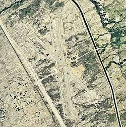
Inyo County Airport is a closed airport located east of Fresno, California.
History
During World War II, the airport was used by the United States Army Air Forces as an auxiliary training airfield for the flying school at Lone Pine Airport, California.
It was later used as a civil airport. The facility closed sometime in the 1950s. The remains of the runways and ground facilities can be seen in aerial imagery.
See also
References
![]() This article incorporates public domain material from the Air Force Historical Research Agency website http://www.afhra.af.mil/.
This article incorporates public domain material from the Air Force Historical Research Agency website http://www.afhra.af.mil/.
External links
- Abandoned & Little-Known Airfields: California: Inyo County
This article is issued from Wikipedia - version of the 3/27/2014. The text is available under the Creative Commons Attribution/Share Alike but additional terms may apply for the media files.