Iowa Highway 316
| ||||
|---|---|---|---|---|
 | ||||
| Route information | ||||
| Maintained by Iowa DOT | ||||
| Length: | 5.183 mi[1] (8.341 km) | |||
| Existed: | June 4, 1935[2] – present | |||
| Major junctions | ||||
| South end: |
| |||
| North end: | East city limits of Runnells | |||
| Location | ||||
| Counties: | ||||
| Highway system | ||||
| ||||

Iowa Highway 316 (Iowa 316) is a 5.183-mile-long (8.341 km) spur route in central Iowa. Iowa 316 begins at Iowa Highway 5 south of Swan, Iowa and ends at the eastern city limits of Runnells. Prior to 2003, Iowa 316 extended north to Iowa Highway 163 north of Runnells, but that portion was turned over to Polk County. Iowa 316's primary purpose is a crossing of the Des Moines River south of Runnells.
Route description
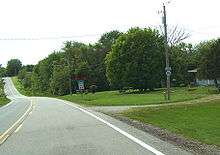
Iowa 316 begins at an intersection with Iowa Highway 5 south of Swan. The first one-sixth mile (270 m) are in Warren County, while the next two and a third miles (3.8 km) of Iowa 316 form the Warren/Marion county border.[1][3] Iowa 316 crosses over a BNSF Railway line and turns into Warren County.[4] For the rest of its length, the highway closely parallels these railroad tracks. Iowa 316 in Warren County is bordered to the south and east by the Middle River and to the north and east by the Des Moines River, and occasionally, Lake Red Rock. The area north of the highway serves as an overflow basin for Lake Red Rock, which is formed by a dam twenty miles (32 km) downstream near Pella.[3] The highway and the railroad tracks approach the main channel on a causeway. Iowa 316 crosses the main channel at the Warren / Polk county line, on a simple girder bridge, while the adjacent railroad crosses on an over-deck truss bridge. Iowa 316 continues north into Polk County on another causeway for two miles (3.2 km), where it curves to the northwest towards Runnells.[1] At the Runnells city limits, Iowa 316 ends abruptly, but the highway continues as McKinney Street.[5]
History
In 1935, Iowa 316 began as a 7-mile-long (11 km) spur route from U.S. Route 163 (US 163) south to Runnells.[2] In 1937, US 163 became Iowa Highway 163.[6] It was extended south to Iowa Highway 5 in the early 1980s, appearing on the state map by 1983.[7] In 2003, the 7 miles (11 km) north of Runnells were turned over to Polk County. The southern portion of Iowa 316 was kept because it is an important crossing of the Des Moines River.
Major intersections
| County | Location | mi[1] | km | Destinations | Notes | |||
|---|---|---|---|---|---|---|---|---|
| Warren | Richland Township | 0.000 | 0.000 | |||||
| Marion |
No major junctions | |||||||
| Warren |
No major junctions | |||||||
| Polk | Runnells | 5.183 | 8.341 | McKinney Street (continuation) | Iowa 316 ends at the Runnells city limits | |||
| 1.000 mi = 1.609 km; 1.000 km = 0.621 mi | ||||||||
References
- 1 2 3 4 "2009 Volume of Traffic on the Primary Road System of Iowa" (PDF). Iowa Department of Transportation. January 1, 2009. Retrieved May 16, 2010.
- 1 2 Hancock, Jason (May 9, 2010). "Iowa Highways: 300 to 319". The Iowa Highways Page. Retrieved May 16, 2010.
- 1 2 Transportation Map (PDF) (Map). Iowa Department of Transportation. 2010. Retrieved May 16, 2010.
- ↑ Iowa State Railroad Map (PDF) (Map). Iowa Department of Transportation. July 1, 2008. Retrieved May 16, 2010.
- ↑ Iowa Department of Transportation (April 15, 2008). "Highway and Street Map of Runnells, Iowa" (PDF). Retrieved May 16, 2010.
- ↑ Hancock, Jason (October 19, 2008). "Other US highways in Iowa". The Iowa Highways Page. Retrieved May 16, 2010.
- ↑ Iowa State Highway Map (PDF) (Map). Iowa Department of Transportation. 1983. Retrieved May 16, 2010.