Ivanjski Vrh, Cerkvenjak
| Ivanjski Vrh | |
|---|---|
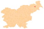
 Ivanjski Vrh Location in Slovenia | |
| Coordinates: 46°35′9.16″N 15°57′47.43″E / 46.5858778°N 15.9631750°ECoordinates: 46°35′9.16″N 15°57′47.43″E / 46.5858778°N 15.9631750°E | |
| Country |
|
| Traditional region | Styria |
| Statistical region | Drava |
| Municipality | Cerkvenjak |
| Area | |
| • Total | 0.27 km2 (0.10 sq mi) |
| Elevation | 260.6 m (855.0 ft) |
| Population (2002) | |
| • Total | 40 |
| [1] | |
Ivanjski Vrh (pronounced [iˈʋaːnski ˈʋəɾx]) is a small settlement in the Municipality of Cerkvenjak in northeastern Slovenia. It lies in the Slovene Hills (Slovene: Slovenske gorice) north of Cerkvenjak, just off the road towards Spodnji Ivanjci. The area was part of the traditional region of Styria and is now included in the Drava Statistical Region.[2]
References
External links
| Settlements | Administrative centre: Cerkvenjak
|  |
|---|---|---|
| Landmarks |
| |
This article is issued from Wikipedia - version of the 12/24/2015. The text is available under the Creative Commons Attribution/Share Alike but additional terms may apply for the media files.