Jianghan District
| Jianghan 江汉区 | ||||||||||||||||||||||||||||||||||||
|---|---|---|---|---|---|---|---|---|---|---|---|---|---|---|---|---|---|---|---|---|---|---|---|---|---|---|---|---|---|---|---|---|---|---|---|---|
| District | ||||||||||||||||||||||||||||||||||||
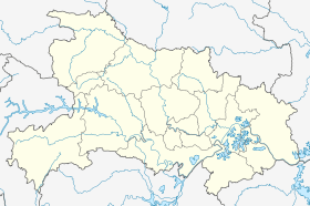 Jianghan Location in Hubei | ||||||||||||||||||||||||||||||||||||
| Coordinates: 30°36′10″N 114°15′51″E / 30.6029°N 114.2642°ECoordinates: 30°36′10″N 114°15′51″E / 30.6029°N 114.2642°E[1] | ||||||||||||||||||||||||||||||||||||
| Country | People's Republic of China | |||||||||||||||||||||||||||||||||||
| Province | Hubei | |||||||||||||||||||||||||||||||||||
| Sub-provincial city | Wuhan | |||||||||||||||||||||||||||||||||||
| Area[2] | ||||||||||||||||||||||||||||||||||||
| • Total | 33.43 km2 (12.91 sq mi) | |||||||||||||||||||||||||||||||||||
| Population (2010)[3] | ||||||||||||||||||||||||||||||||||||
| • Total | 683,492 | |||||||||||||||||||||||||||||||||||
| • Density | 20,445/km2 (52,950/sq mi) | |||||||||||||||||||||||||||||||||||
| Time zone | China Standard (UTC+8) | |||||||||||||||||||||||||||||||||||
| Wuhan district map |
| |||||||||||||||||||||||||||||||||||
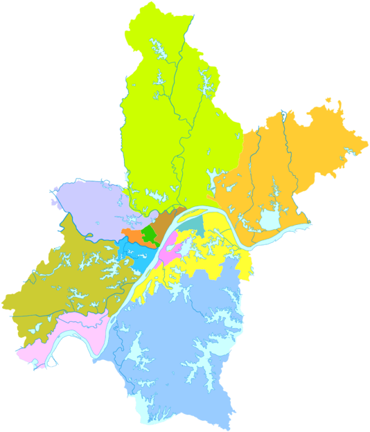
Jianghan District (simplified Chinese: 江汉区; traditional Chinese: 江漢區; pinyin: Jiānghàn qū) forms part of the urban core of and is one of 13 districts of Wuhan, the capital of Hubei province, People's Republic of China, and is situated on the northwest (left) bank of the Yangtze River. It is both the least spacious and most densely populated of the districts of Wuhan.[2][3] On the left bank of the Yangtze, it borders Dongxihu to the north, Jiang'an to the northeast, Hanyang to the south, and Qiaokou to the west; on the opposite bank it borders Wuchang.
References
- ↑ Google (2014-07-02). "Jianghan" (Map). Google Maps. Google. Retrieved 2014-07-02.
- 1 2 "Wuhan Statistical Yearbook 2010" (PDF). Wuhan Statistics Bureau. p. 15. Archived from the original (PDF) on November 5, 2011. Retrieved 2011-07-31.
- 1 2 "武汉市2010年第六次全国人口普查主要数据公报" (in Chinese). Wuhan Statistics Bureau. 2011-05-11. Archived from the original on 2011-10-25. Retrieved 2011-06-11.
External links
This article is issued from Wikipedia - version of the 11/7/2016. The text is available under the Creative Commons Attribution/Share Alike but additional terms may apply for the media files.