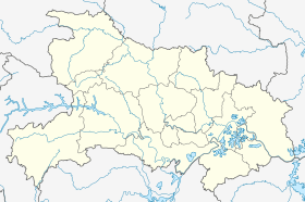
Fancheng District
| Fancheng 樊城区 | |
|---|---|
| District | |
 Fancheng Location in Hubei | |
| Coordinates: 32°02′42″N 112°08′10″E / 32.045°N 112.136°ECoordinates: 32°02′42″N 112°08′10″E / 32.045°N 112.136°E | |
| Country | People's Republic of China |
| Province | Hubei |
| Prefecture-level city | Xiangyang |
| Area | |
| • Total | 482.2 km2 (186.2 sq mi) |
| Population (2004) | |
| • Total | 630,000 |
| • Density | 1,300/km2 (3,400/sq mi) |
| Time zone | China Standard (UTC+8) |
|
Fancheng (the former city) | |||||||||
| Chinese | 樊城 | ||||||||
|---|---|---|---|---|---|---|---|---|---|
| Postal | Fancheng | ||||||||
| |||||||||
Fancheng District (simplified Chinese: 樊城区; traditional Chinese: 樊城區; pinyin: Fánchéng Qū) is a district of the city of Xiangyang, Hubei, People's Republic of China.
History
Fancheng was an ancient city in Hubei, situated on the northern side of the Han River, opposite Xiangyang on the southern side of the river. Throughout history, the city has served both military and economic purposes, and was famous for numerous battles including the Battle of Fancheng during the Three Kingdoms period and the Siege of Xiangyang during the Mongol invasions.
In 1949, Fancheng was merged with Xiangyang to form Xiangfan, a prefecture-level city. Fancheng is now a district of that city, encompassing 482.2 km2 (186 sq mi) and having a population of 630,000, according to a 2004 census.