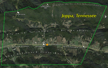
Joppa, Tennessee
| Joppa | |
|---|---|
| Unincorporated community | |
|
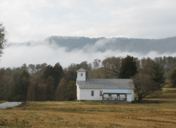
Joppa United Methodist Church shadowed by Joppa (Clinch) Mountain | |
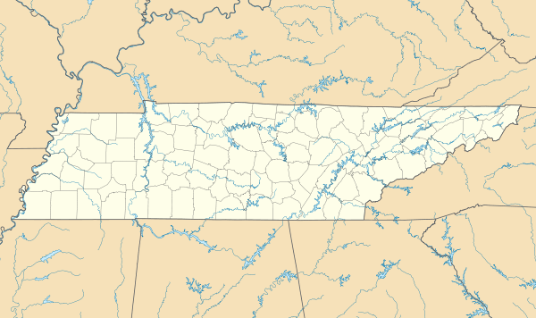 Joppa Location in Grainger County and the State of Tennessee | |
| Coordinates: 36°14′17″N 083°36′56″W / 36.23806°N 83.61556°WCoordinates: 36°14′17″N 083°36′56″W / 36.23806°N 83.61556°W | |
| Country | United States |
| State | Tennessee |
| County | Grainger |
| Elevation | 965 ft (294 m) |
| Time zone | Eastern (EST) (UTC-5) |
| • Summer (DST) | EDT (UTC-4) |
| ZIP code | 37861 |
| Area code | 865 |
| FIPS code[1] | 47-38680 |
| GNIS feature ID[1][2] | 1289831 |
Joppa is an unincorporated community in rural west-central Grainger County, Tennessee, United States.[2] It rests below Joppa Mountain, a subrange located at the southern base of the 150 mile (240 km) long Clinch Mountain Ridge, offering views of five U.S. States. It is part of the Morristown, Tennessee Metropolitan Statistical Area, and also a component of the Knoxville-Morristown-Sevierville Combined Statistical Area.
Nestled in the foothills of the Great Smoky Mountains, the Joppa community is a quilted patchwork of rolling farms, lush woodlands, scenic water flows and mountainous terrain that attract many outdoor enthusiasts.
History


Joppa is situated along the Federal Road (US-11W - Rutledge Pike), formerly known as the Old Lee Highway, which connected New Orleans and Washington, D.C. The road intersected the Old Kentucky Road (now US-25E - Dixie Highway) at Bean Station, just east of Rutledge.[3]
Early during the American Civil War, Confederate cannons were mounted at the Powder Spring Gap on the Clinch Mountain Ridge facing the Clinch Valley in order to prevent Union forces crossing from the northwest side of the ridge to the Federal Road and the Richland Valley to the southeast. As the war progressed, Confederate soldiers engaged in guerrilla warfare tactics from numerous vantage points along the Clinch Mountain Ridge including the rocks and caves around Joppa Mountain's summit at Buzzard Rock where they extracted salpetre, one of the ingredients of gunpowder, from the droppings of buzzards.
This guerrilla warfare largely paralyzed Grainger County during the American Civil War. Confederate General James Longstreet, who had earlier failed to wrest Knoxville from Union forces, on December 14, 1863, in what became known as the Battle of Bean's Station, attacked a Union detachment that had been pursuing him. The Confederates failed to exploit the element of surprise, and the Union forces were able to hold out until reinforcements arrived. While Longstreet was victorious, Union forces were able to retreat through Joppa en route to fortifications at Blaine, and Longstreet subsequently abandoned the assault and continued his retreat from Knoxville eastward to winter quarters at Russellville. He rejoined the Army of Northern Virginia the following Spring.[4]
The Old Joppa School (known today as Joppa Elementary School) was built circa 1878 and burned in approximately 1899. In 1900, a second building was built to accommodate grades 1-8, until it was demolished in 1966 to make way for a third building that was built in 1967.
In 1881, Sunday school service was started in the Old Joppa School. On December 26, 1921 John and Mary Morgan deeded 1/4 acre of land, and in 1922 the Church (known today as Joppa United Methodist Church)[5] was organized. On May 4, 1924 the current Church building was dedicated.
In approximately 1894, Professor P.E. Aston, who taught at the former Sulphur Springs Academy, approached the Tennessee State Legislature, and was subsequently successful in having the name of Spring House Post Office (1845–1893) changed to Joppa. The post office was then moved from a location near Ellis Farm on Blaines Chapel Road to the J.H. Hammer Store near the intersection of U.S. Route 11W and Joppa Mountain Road, where it was then changed to the name of Joppa Post (1933–1950) until its closure. In April 2012, the Grainger County Board of Education authorized negotiations to purchase the old Joppa Post store for possible future use as a drip field for the sewer system at Joppa Elementary School. On June 18, 2012, the Grainger County BOE completed the purchase of the old Joppa Post store for $28,500, and soon after the structure was razed.
Cherokee Lake, created by the Tennessee Valley Authority in 1941 with the completion of Cherokee Dam, is located just southeast of Joppa.
_Mountain.jpg)
Hang Gliding from Joppa (Clinch) Mountain was (and still is) the goal of many hang gliding enthusiasts around the world according to the president of one of the largest hang gliding associations in the United States. Hang gliding on Joppa (Clinch) Mountain started in the mid-1970s and enjoyed considerable notoriety until the late 1980s. The 1979 USHPA regional competition was held on Joppa (Clinch) Mountain, which is also the site of the Tennessee Flex Wing Free Flight Record of 68.3 miles by Ellis Newkirk. The Locals describe the weekends around the Joppa & Powder Springs communities as being full of activities with spectators lined along U.S. Route 11W (Rutledge Pike) & TN State Route 131 as hang gliders would launch from Buzzard Rock, on the Joppa Mountain summit, and glide over the Poor, Richland, and Clinch Valleys landing at various local landing zones or destinations as far away as Virginia, Kentucky, and Chattanooga, Tennessee.
Geography
Joppa is located at 36°14′16.76″N 83°36′55.71″W / 36.2379889°N 83.6154750°W (36.279991, -83.518008).[6] The community is situated along the Richland & Poor Valleys. The Richland Valley is a narrow valley that stretches for some 35 miles (56 km) along the southern base of the Clinch Mountain Ridge between Blaine and Rutledge. Richland Creek traverses most of the valley en route to its confluence along the Cherokee Lake impoundment of the Holston River, approximately 14 miles (23 km) downstream from Joppa.

The Joppa community encompasses an area of about 12 square miles (31 km2) that runs roughly from the top of the Clinch Mountain Ridge just southwest of where Joppa Mountain Road crosses at Powder Spring Gap, then runs about 4.5 miles (7.2 km) northeasterly along the ridge to just above where the intersection of Corbin Lake and Poor Valley Roads meet between the Poor Valley Knobs and then turns south and runs roughly 2.5 miles (4.0 km) across U.S. Route 11W to the top of the Richland Knobs near Owl Hole Gap Road. From there, it runs another 4.5 miles (7.2 km) southwesterly along the top of the Richland Knobs.
Joppa is centered around Joppa Elementary School located at the junction of the Federal Road U.S. Route 11W Rutledge Pike, which connects the community to Kingsport to the east and Knoxville to the west, and Joppa Mountain Road, which traverses the Clinch Mountain Ridge via the Powder Spring Gap to the Powder Springs Community to the northwest. Starting from the Clinch Mountain Ridge's southern terminus at Signal Point peak near Blaine, Tennessee, Joppa Mountain Road is the first of only twelve transportation crossings from southwest to northeast along its entire 150-mile (240 km) length.
From the Joppa Mountain summit at Buzzard Rock, elevation 2,530 feet (770 m), the U.S. States of Georgia, Kentucky, North Carolina, Virginia, the entire breadth of Eastern Tennessee, as well as, the Great Smoky Mountains and the Cumberland Gap can be seen.
Natural history
Geology
Even by a geologist's standards, the Appalachians are very old mountains: The bedrock was formed 1 billion years ago and the mountains are 500 million years old, 10 times older and once taller than the Rockies, Sierras, Andes, and Himalayas. They have been created, worn down, and created again as a result of tectonic and weathering forces. Continental drift, a phenomenon that continues on earth's surface today, has played a major role.
The legacy of tectonic events in East Tennessee created the mountainous physiographic province known as the Valley and Ridge (commonly known as the Great Valley of East Tennessee), within which Joppa, TN is situated. [7] The Valley and Ridge takes its name from its long ridges and valleys oriented in a northeast-southwest direction. This topography was shaped by folding and faulting that occurred during the middle Ordovician period of the Paleozoic Era by the collision of plates. Great force from the east, possibly from northern Africa colliding into eastern North America, rippled the landscape like a rug pushed against a wall from one side. The collision which caused the uplift of the mountains began around 440 to 480 million years ago and ended around 230 million years ago. Then erosion set in, shaping more resistant rock into ridges and cutting valleys into weaker ones. The area is dominated by dolomite and highly erodible limestone, making caves numerous. The region has great habitat diversity and supports an especially diverse fish fauna, including the Upper Clinch River, which holds one of the most diverse fish faunas in North America.[8]
Chestnut Flat
A small playa (flat) area below and just to the southwest of the Joppa Mountain summit named Chestnut Flat[9] was once home to a large population of American Chestnut trees, some of which may have reached heights of up to 200 feet. The pathogenic fungus is the causal agent of Chestnut blight, a devastating disease of the American Chestnut tree that caused a mass extinction of this once plentiful tree by 1920 in Grainger County, and by 1940 from its historic range in the eastern United States.
References
- 1 2 "FIPS55 Data: Tennessee". FIPS55 Data. United States Geological Survey. February 23, 2006. Archived from the original on June 18, 2006. External link in
|work=(help) - 1 2 "Joppa (Grainger County, Tennessee)". Geographic Names Information System. United States Geological Survey. Retrieved May 9, 2014.
- ↑ Kevin Collins, Grainger County. The Tennessee Encyclopedia of History and Culture, 2002. Retrieved: February 19, 2008.
- ↑ The National Park Service, "Battle Summary: Bean's Station, Tennessee." Retrieved: February 19, 2008.
- ↑ "Joppa United Methodist Church". Geographic Names Information System. United States Geological Survey. Retrieved May 9, 2014.
- ↑ "US Gazetteer files: 2010, 2000, and 1990". United States Census Bureau. 2011-02-12. Retrieved 2011-04-23.
- ↑ [[[:Template:Http://www.nrcs.usda.gov/Internet/FSE MANUSCRIPTS/tennessee/graingerTN1948/graingerTN1948.pdf]] "Soil Survey Grainger County Tennessee, Series 1940, Issued November 1948"] Check
|url=value (help) (PDF). Tennessee Agricultural Experiment Station. United States Department of Agriculture. Retrieved September 7, 2016. - ↑ Vernon and Cathy Summerlin, Longstreet Highroad Guide to the Tennessee Mountains Published (print): 1999, Published (Web): January, 2003, ISBN 1-56352-475-9. Retrieved: June 2, 2011
- ↑ "Chestnut Flat". Geographic Names Information System. United States Geological Survey. Retrieved May 9, 2014.
Municipalities and communities of Grainger County, Tennessee, United States | ||
|---|---|---|
| City | ||
| Towns | ||
| Unincorporated communities | ||