Kako, Bihar
| Kako | |
|---|---|
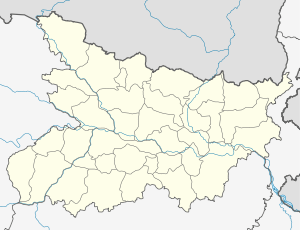 Kako  Kako Location in Bihar, India | |
| Coordinates: 25°13′0″N 85°4′0″E / 25.21667°N 85.06667°ECoordinates: 25°13′0″N 85°4′0″E / 25.21667°N 85.06667°E | |
| Country |
|
| State | Bihar |
| District | Jehanabad |
| Elevation | 60 m (200 ft) |
| Languages | |
| • Official | Hindi, Urdu |
| Time zone | IST (UTC+5:30) |
| PIN | 804418 |
| Telephone code | 06114 |
| Vehicle registration |
BR-25 Population(2011) =23037 |
| Coastline | 0 kilometres (0 mi) |
| Nearest city | Jehanabad |
| Lok Sabha constituency | Jehanabad |
Kako is a town in Jehanabad district of Bihar, a state in India. Until 1984, Kako was a part of the Gaya district. This region now belongs to the Magadh commissary, however until 2010 it belonged to the Jehanabad constituency of Vidhansabha assembly. Kako is now in GHOSHI vidhasabha assembly. Population density is very high in this region, but basic infrastructure is not optimal.
Demographics
Kako is located in the Jehanabad district (Bihar) with a total of 3554 families residing within it. Kako has a population of 23037, of which 11890 are male while 11147 are female (as of the 2011 census). Children under the age of 6 make up 18.08% (around 4165 children) of the total population of the village. Average Sex Ratio of Kako is 938, which is higher than Bihar state average of 918. Child Sex Ratio for the Kako as per census is 944, higher than Bihar average of 935. Kako has a higher literacy rate compared to Bihar. In 2011, the literacy rate of Kako was 67.22% compared to 61.80% of Bihar. In Kako Male literacy stands at 76.77% while female literacy rate was 57.02%.
Geography
It is located at an elevation of 60 km above MSL.[1] Temperature varies from 5–45 °C. Climate of Kako is extreme in nature that is very hot in summer and very cold in winter. Average rainfall is 1074.2mm. Out of 90 percent comes from mansoons. Soil is very much fertile known KEWAL in local term.
Agriculture
Most of the people of Kako Block depends on agriculture. Main crops of Kako is Rice, wheat and Pulses. There ponds is there in Kako which helps in agriculture. Lands of Kako is very much fertile. Some people are also engage in vegetable farming.
Tourism
Sun temple - Sun temple is situated in Kako, which draws many locals to Kako during Chatpuga.
Hajrat Bibi Kamal - This place is situated only 2 km from Kako. Bibi Kamal’s Urs takes place in November every year when cooked rice is distributed among devotees seeking her blessings.
The Barabar hill - This place is only 22 km from Kako. The Archaeological survey of India (ASI) has also sent a proposal to the UNESCO for inclusion of Barabar hills in the world heritage list of monuments.
The Nalanda - Nalada, which is famous in India, is only 57 km from Kako. Very famous Buddhist tourist place Rajgir is 67 km from Kako .
Bodh Gaya - Bodh gaya is 73 km from Kako .
Location
National Highway 110 passes through Kako. The closest airport to Kako is Patna & Gaya, and the Nearest railway station is Jehanabad, which is 8 km away.
Ramayana Circuit - As per local legends and Ramayana Story, Lord Ram's step mother, Rani Kekaiy of Ayodhya lived there for some time, and the village took its name after her. Hajrat Bibi Kamal - The village has also a tomb of Hazarat Bibi, Kamal Sahiba; a great Muslim lady saint. District Jail is also situated here.
Mandal Jail - Mandal jail is also situted in Kako.