De Zoom – Kalmthoutse Heide
| De Zoom - Kalmthoutse Heide Cross-Border Park | |
|---|---|
| Grenspark De Zoom - Kalmthoutse Heide | |
|
IUCN category II (national park) | |
 | |
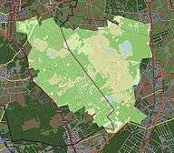 Map of the National Park | |
| Location | North Brabant, Netherlands and Antwerp, Belgium |
| Coordinates | 51°23′43″N 4°26′28″E / 51.39528°N 4.44111°ECoordinates: 51°23′43″N 4°26′28″E / 51.39528°N 4.44111°E |
| Area | 37.5 km2 (14.5 sq mi) |
| Established | 2001 |
| Governing body | Bijzondere Commissie "Grenspark De Zoom-Kalmthoutse Heide" |
| http://www.grensparkzk.nl/ | |
| Designated | 4 March 1986 |
.jpg)
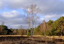
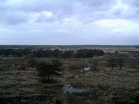
De Zoom – Kalmthoutse Heide, is a cross-border park on the Belgian-Dutch border. It is a merger of two former parks, the Kalmthoutse Heide in Belgium and De Zoom in the Netherlands), together extending over 37.50 square kilometres (14.48 sq mi). A very large part of the park is covered with heath.
The park is managed by a special commission in which both Flemish and Dutch organisations are represented. The park is owned by the state of Flanders, the municipality Kalmthout, Staatsbosbeheer, Natuurmonumenten and several private owners. The best known part of the border park lies in Belgium, in the north of the province of Antwerp (Kalmthout and Essen). The Dutch part lies in the municipality Woensdrecht (province North Brabant) and stretches from the border to the villages Huijbergen and Putte.
External links
| Wikimedia Commons has media related to Kalmthoutse Heide. |