Kamuli
| Kamuli | |
|---|---|
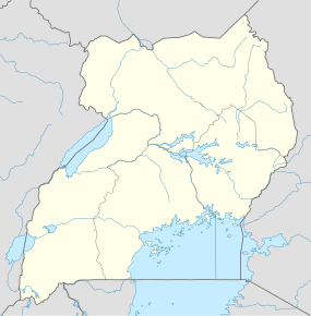 Kamuli Location in Uganda | |
| Coordinates: 00°56′42″N 33°07′30″E / 0.94500°N 33.12500°E | |
| Country |
|
| Region | Eastern Uganda |
| Sub-region | Busoga sub-region |
| District | Kamuli District |
| Elevation | 3,600 ft (1,100 m) |
| Population (2014 Census) | |
| • Total | 17,725[1] |
Kamuli is a town in the Eastern Region of Uganda. It is the main municipal, administrative, and commercial center of Kamuli District,[2] and the district headquarters are located there. The district is named after the town.
Location
Kamuli is approximately 72 kilometres (45 mi), by road, north of Jinja, the largest city in the Busoga sub-region, on an all weather tarmac highway.[3] The coordinates of Kamuli are 0°56'42.0"N, 33°07'30.0"E (Latitude:0.9450; Longitude:33.1250).[4]
Population
According to the 2002 national census, the population of Kamuli was about 11,350. In 2010, the Uganda Bureau of Statistics (UBOS) estimated the population of the town at 14,700. In 2011, UBOS estimated the mid-year population of Kamuli at 15,200.[5] The 2014 national population census put the population at 17,725.[1]
Administration
The town is administered by a Municipal Council headed by a mayor. There is an elected Municipal Council of fifteen councilors. The annual budget for the municipality in 2002 was US$337,545.
Points of interest
The following points of interest lie within the town limits or close to its borders:
- The headquarters of Kamuli District Administration
- The offices of Kamuli Town Council
- Kamuli Central Market
- Kamuli Mission Hospital - A 160-bed pr
- Ugandan Towns
- List of roads in Uganda
Photos
References
- 1 2 UBOS (27 August 2014). "The Population of The Regions of the Republic of Uganda And All Cities And Towns of More Than 15,000 Inhabitants". Citypopulation.de Quoting Uganda Bureau of Statistics (UBOS). Retrieved 26 February 2015.
- ↑ Namukoye, Geoffrey (24 August 2015). "Kamuli receives municipality status with mixed feelings". New Vision. Kampala. Retrieved 24 August 2015.
- ↑ "Distance Between Jinja And Kamuli With Map". Globefeed.com. Retrieved 12 May 2014.
- ↑ Google (10 July 2015). "Location of Kamuli At Google Maps" (Map). Google Maps. Google. Retrieved 10 July 2015.
- ↑ UBOS. "Estimated Population of Kamuli In 2002, 2010 & 2011" (PDF). Uganda Bureau of Statistics (UBOS). Retrieved 17 April 2014.
External links
Capital: Kamuli | ||
| Towns and villages |
| |
| Economy | ||
| Energy | ||
| Health | ||
| Notable landmarks | ||
| Education |
| |
| Transport |
| |
| Notable people |
| |
Coordinates: 00°56′42″N 33°07′30″E / 0.94500°N 33.12500°E