Regions of Uganda
Central - Western - Eastern - Northern
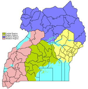
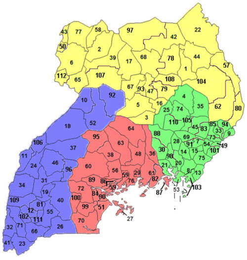
The regions of Uganda are known as Central, Western, Eastern, and Northern. These four regions are in turn divided into districts. There were 56 districts in 2002,[1] which expanded into 111 districts plus one city (Kampala) by 2010.[2]
The national government interacts directly with the districts today, so regions do not have any definite role in the administration. Under British rule prior to 1962 the regions were functional administrative units and were called provinces, headed by a Provincial Commissioner. The central region is the kingdom of Buganda, which then had a semi-autonomous government headed by the Kabaka (king). The equivalent of the Privincial commissioner for Buganda was called the Resident. (ref, Uganda Protectorate annual report, Government Printer, Entebbe, 1959)
At Uganda's 2002 census, the Central region contained 27% of the country's population, the Western region contained 26%, and Eastern region 25%, and the Northern region had 22%.[1]
The country's population density by region was: 226 persons per square kilometre in the Eastern region, 176 per square kilometre in the Central region, 126/km2 in the Western region, and 65/km2 in the Northern region.[1]
In 2002 approximately 3 million people, or 12% of the country's population, lived in urban areas. The Central region contained 54% of the urban population (mostly in the city of Kampala), the Northern region 17%, the Western region 14%, and the Eastern region 13%.[1]
| Region | Population (Census 1991) | Population (Census 2002) | Population (Census 2014) | Area |
|---|---|---|---|---|
| Central | 4,843,594 | 6,575,425 | 9,529,227 | 61,403.2 km2 (23,707.9 sq mi) |
| Western | 4,547,687 | 6,298,075 | 8,874,862 | 55,276.6 km2 (21,342.4 sq mi) |
| Eastern | 4,128,469 | 6,204,915 | 9,042,422 | 39,478.8 km2 (15,242.8 sq mi) |
| Northern | 3,151,955 | 5,148,882 | 7,188,139 | 85,391.7 km2 (32,969.9 sq mi) |
See also
- Districts of Uganda
- Counties of Uganda
- Sub-counties of Uganda
- Uganda Local Governments Association
- ISO 3166-2 codes for Ugandan regions and districts
References
- 1 2 3 4 "2002 Uganda Population and Housing Census" (PDF). Uganda Bureau of Statistics. Retrieved 18 June 2013. External link in
|publisher=(help) - ↑ "Status of Local Governments". Ministry of Local Government. Archived from the original on 18 September 2010.
- ↑ "Uganda: Administrative units (source: Uganda Bureau of Statistics)". GeoHive. Retrieved 18 June 2013.
- ↑ "Uganda: Administrative Division". citypopulation.de. Retrieved 8 November 2016.
External links

Wikimedia Commons has media related to Regions of Uganda.