Karima, Sudan
| Karima | |
|---|---|
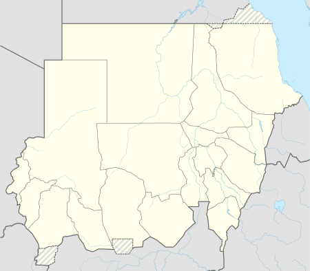 Karima Location in Sudan | |
| Coordinates: SD 18°33′N 31°51′E / 18.550°N 31.850°E | |
| Country |
|
| Admin. division | Northern (state) |
Karima is a town in Northern State in Sudan some 400 km from Khartoum on a loop of the Nile.
The hill of Jebel Barkal is near Karima. Beside it are the ruins of Napata, a city-state of ancient Nubia on the west bank of the Nile River, including the temple of Amun. The Shaigiya tribe lived around Karima and Korti, but suffered for their support of the British against the Mahdi. The land around Karima is a center for cultivation of Barakawi dates. Karima is a terminus of a branch narrow gauge railway of the Sudan Railways system.
Climate
Karima has a hot desert climate (Köppen climate classification BWh).
| Climate data for Karima, Sudan (1961–1990) | |||||||||||||
|---|---|---|---|---|---|---|---|---|---|---|---|---|---|
| Month | Jan | Feb | Mar | Apr | May | Jun | Jul | Aug | Sep | Oct | Nov | Dec | Year |
| Record high °C (°F) | 37.3 (99.1) |
41.6 (106.9) |
45.5 (113.9) |
46.6 (115.9) |
48.0 (118.4) |
48.1 (118.6) |
47.5 (117.5) |
46.6 (115.9) |
46.6 (115.9) |
44.7 (112.5) |
40.8 (105.4) |
37.5 (99.5) |
48.1 (118.6) |
| Average high °C (°F) | 28.0 (82.4) |
30.5 (86.9) |
34.7 (94.5) |
38.8 (101.8) |
42.0 (107.6) |
43.4 (110.1) |
41.9 (107.4) |
41.4 (106.5) |
42.1 (107.8) |
39.2 (102.6) |
33.2 (91.8) |
29.4 (84.9) |
37.0 (98.6) |
| Daily mean °C (°F) | 19.1 (66.4) |
22.0 (71.6) |
26.0 (78.8) |
30.1 (86.2) |
33.5 (92.3) |
35.1 (95.2) |
34.5 (94.1) |
34.4 (93.9) |
34.6 (94.3) |
31.5 (88.7) |
25.6 (78.1) |
21.6 (70.9) |
29.0 (84.2) |
| Average low °C (°F) | 11.9 (53.4) |
13.5 (56.3) |
17.3 (63.1) |
21.5 (70.7) |
25.1 (77.2) |
26.9 (80.4) |
27.0 (80.6) |
27.1 (80.8) |
27.1 (80.8) |
23.8 (74.8) |
18.0 (64.4) |
13.8 (56.8) |
21.1 (70) |
| Record low °C (°F) | 3.6 (38.5) |
3.8 (38.8) |
7.5 (45.5) |
10.0 (50) |
16.7 (62.1) |
19.5 (67.1) |
20.7 (69.3) |
21.0 (69.8) |
19.0 (66.2) |
13.2 (55.8) |
7.7 (45.9) |
5.5 (41.9) |
3.6 (38.5) |
| Average precipitation mm (inches) | 0.0 (0) |
0.0 (0) |
0.0 (0) |
0.0 (0) |
0.1 (0.004) |
0.1 (0.004) |
7.7 (0.303) |
11.4 (0.449) |
1.1 (0.043) |
0.3 (0.012) |
0.0 (0) |
0.0 (0) |
20.7 (0.815) |
| Average precipitation days (≥ 0.1 mm) | 0.1 | 0.0 | 0.0 | 0.0 | 0.2 | 0.2 | 1.0 | 1.7 | 0.5 | 0.1 | 0.0 | 0.0 | 3.8 |
| Average relative humidity (%) | 30 | 23 | 19 | 17 | 16 | 17 | 24 | 29 | 22 | 23 | 29 | 33 | 23.5 |
| Mean monthly sunshine hours | 316.2 | 296.8 | 325.5 | 324.0 | 328.6 | 312.0 | 322.4 | 300.7 | 282.0 | 319.3 | 303.0 | 288.3 | 3,718.8 |
| Percent possible sunshine | 91 | 92 | 86 | 86 | 84 | 79 | 79 | 79 | 76 | 87 | 94 | 93 | 86 |
| Source: NOAA[1] | |||||||||||||
See also
References
- ↑ "Karima/Kuraymah Climate Normals 1961–1990". National Oceanic and Atmospheric Administration. Retrieved January 18, 2016.
Coordinates: 18°33′00″N 31°51′00″E / 18.55000°N 31.85000°E
This article is issued from Wikipedia - version of the 2/18/2016. The text is available under the Creative Commons Attribution/Share Alike but additional terms may apply for the media files.