Kayoa
| Native name: <span class="nickname" ">Pulau Urimatiti | |
|---|---|
 | |
| Geography | |
| Coordinates | -0.0833333, 127.417 |
| Archipelago | Maluku Islands |
| Highest elevation | 422 m (1,385 ft) |
| Highest point | Mount Tigalalu |
| Administration | |
|
Indonesia | |
| Province | North Maluku |
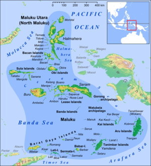
Kayoa (also Kaioa), or in the native language Pulau Urimatiti, is an island, one of the Maluku Islands. It is located in South Halmahera Regency, North Maluku administrative division of Indonesia.
Geography
Kayoa island is near the southern end of a chain of volcanic islands off the western coast of Halmaherato (Halmahera region), to the south of Makian and to the north of Bacan.[1] The main island is about 10 miles (16 km) long, about 9 miles (14.5 km) south of Makian with a line of hills along most of its length.[2]
The islands were for centuries the only place in the world where cloves were produced. Kayoa lies on the equator and is subject to regular heavy rain in the two monsoon seasons, which are December to March and June to July.[3]
The stratovolcano Mount Tigalalu lies at the western end of Kayoa, partly flanked by coral limestones.[4] However, Kayoa island differs from its neighbours in being composed mainly of sedimentary rather than volcanic rock. Its western side consists of terraces of raised coral limestone with pumice and beach sand.[3]
Languages and archaeology
There are two native languages on Kayoa island, as well as Indonesian. The language named West Makian, spoken by 5,000 people in Kayoa and its outlying islands, is one of the North Halmahera languages, which appear to be members of the West Papuan family of languages.[5] The language named Taba or East Makian is one of the Austronesian languages.[6]
Archaeological evidence shows a foraging culture on Kayoa before around 3,500 years ago, changing at that time to an agricultural way of life with animals including pigs and dogs, red-slipped pottery, shell bracelets and beads, and polished stone tools such as adzes. This change shows the arrival on Kayoa of a new culture by 1500 BC.[7][8] From 2,000 years ago the islands started to trade spices to India and beyond.[7] Chinese copper money is found in jar burials of between 2,000 and 1,000 years ago in the Uattamdi cave shelter on Kayoa, implying that trade in cloves began early on the island. With the jars are glass beads, pieces of bronze and iron, and large shells from the coral reef. One of the burial vessels has rectangular and triangular patterns like those found at Leang Buidane but not on nearby islands.[3]
Natural history

Naturalist Alfred Russel Wallace visited Kayoa, as described in his 1869 book The Malay Archipelago.[9] He records that
The next day (October 16th [1858]) I went beyond the swamp, and found a place where a new clearing was being made in the virgin forest... I have never in my life seen beetles so abundant as they were on this spot. Some dozen species of good-sized golden Buprestidae, green rose-chafers (Lomaptera), and long-horned weevils (Anthribidae) were so abundant that they rose up in swarms as I walked along, filling the air with a loud buzzing hum. Along with these, several fine Longicorns were almost equally common, forming such an assemblage as for once to realize that idea of tropical luxuriance which one obtains by looking over the drawers of a well-filled cabinet... It was a glorious spot, and one which will always live in my memory as exhibiting the insect-life of the tropics in unexampled luxuriance.— Wallace[10]
References
- ↑ "Kayoa". GetaMap.net. Retrieved 22 March 2013.
- ↑ Anon (1916). Publications of the United States Hydrographic Office. Hydrographic Office. p. 91.
- 1 2 3 Peregrine, Peter Neal; Ember, Melvin, eds. (2001). "Uattamdi". Encyclopedia of Prehistory. 3: East Asia and Oceania. Springer. ISBN 0306462575.
- ↑ "Tigalalu". Global Volcanism Program. Smithsonian Institution. Retrieved 22 March 2013.
- ↑ Watuseke, F.S. (September 1976). "LinguisticsWest Makian, a Language of the North-Halmahéra Group of the West-Irian Phylum". Anthropological Linguistics. 18 (6): 274–285. JSTOR . 30027583 .
- ↑ Bowden, John; Hajek, John (June 1996). "Phonetic Representation Illustrations of the IPA: Taba". Journal of the International Phonetic Association. 26 (1): 55–57. doi:10.1017/S0025100300005326.
- 1 2 Bellwood, Peter (1997). "The archaeology of Papuan and Austronesian prehistory in the Northern Moluccas, Eastern Indonesia". In Blench, Roger; Spriggs, Matthew. Archaeology and Language II: Archaeological Data and Linguistic Hypotheses. Psychology Press. pp. 128–129.
- ↑ Ooi, Keat Gin (2004). Southeast Asia: A Historical Encyclopedia, from Angkor Wat to East Timor, Volume 1. ABC-CLIO. p. 954. Retrieved 23 March 2013.
- ↑ Wallace, 1869. Volume 2, Chapter 23. pp. 28–33.
- ↑ Wallace, 1869. Volume 2, pp. 31–32.
Bibliography
- Wallace, Alfred Russel (1869). The Malay Archipelago: The land of the orang-utan, and the bird of paradise. A narrative of travel, with sketches of man and nature (1 ed.). Macmillan.
Coordinates: 00°4′N 127°25′E / 0.067°N 127.417°E