Kentucky Route 880
| ||||
|---|---|---|---|---|
| Route information | ||||
| Maintained by KTC | ||||
| Length: | 2.834 mi[1] (4.561 km) | |||
| Existed: | February 9, 1983[2] – present | |||
| Major junctions | ||||
| West end: |
| |||
| East end: |
| |||
| Location | ||||
| Counties: | Warren | |||
| Highway system | ||||
| ||||

Kentucky Route 880 is a 3-mile-long east–west state highway that forms a connector between U.S. Route 231 and KY 234 in the city of Bowling Green, Kentucky. The western terminus of the route is at U.S.231 in Bowling Green. The eastern terminus is at Kentucky Route 234 near the community of Indian Hills east of downtown.
Route description
Previous routing
The old route started at the junction of KY 185 (Sixth Avenue) and Gordon Avenue near downtown Bowling Green. KY 185 turned north onto Gordon Avenue while Sixth Avenue became Veterans Memorial Boulevard and KY 880. From its starting point, KY 880 ran approximately 3.6 miles (5.8 km) around northwestern Bowling Green, intersecting Kentucky Route 2665 (Glen Lily Road) ahead of a junction with U.S. Route 231. US 231 turned south onto the loop, joining KY 880, while U.S. Route 231 Business, the former routing of US 231 into downtown Bowling Green, continued east.
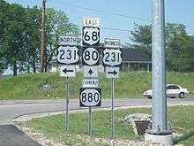
The conjoined routes, collectively named Campbell Lane, ran for five miles (8 km) around the southern portion of Bowling Green, passing through one of the main commercial districts of the city. 1.5 miles (2.4 km) into the concurrency, US 231 and KY 880 intersect the conjoined U.S. Route 68/Kentucky Route 80. Two intersections to the east, Campbell Lane meets U.S. Route 31W. The routes remained overlapped to another intersection with US 231 Business, where US 231 separated from the loop and followed its previous alignment south out of the city. The old route also contained the current route from this point eastward.
Current routing
Starting at a junction with US 231 and US 231 business, KY 880 runs to the northeast for approximately three miles as Lovers Lane until reaching its eastern terminus at KY 234, less than a mile from Interstate 65 exit 26.
KY 880 is currently partially two lanes before bridging out into four lanes near its Eastern Terminus.Lovers Lane is currently undergoing widening to accommodate increased residential and commercial buildup along the remaining two lane section.[2]
History
KY 880 was added to the State Secondary and Rural Secondary systems on February 9, 1983. On April 6, 1990, the Northwest Bypass, a 4.389-mile (7.063 km) segment of KY 880 between KY 185 and Tomblinson Way, was added to the State Secondary System. An additional 0.638 miles (1.027 km) were added to KY 880 on May 18, 1992.
On August 9, 1999, US 231 was rerouted onto KY 880 between its two junctions with KY 880 west and south of the city, forming a concurrency between the two routes. The former alignment of US 231 through Bowling Green was re-designated as US 231 Business.
In March 2008, a good deal of the former length of KY 880 was redesignated as new routing for, from west to east, US 68, KY 80, and US 231. The portion of the highway that was formerly conjoined with US 231 is now designated solely as that highway.
Major intersections
The entire route is in Warren County.
| Location | mi[1] | km | Destinations | Notes | |
|---|---|---|---|---|---|
| Bowling Green | 0.000 | 0.000 | |||
| Mount Victor | 2.834 | 4.561 | |||
| 1.000 mi = 1.609 km; 1.000 km = 0.621 mi | |||||
References
- 1 2 Commonwealth of Kentucky. "Official DMI Route Log". Retrieved October 1, 2011.
- 1 2 "Kentucky Transportation Cabinet – Division of Planning – State Primary Road System Listings (Warren County)" (PDF). Retrieved 2007-04-13.