Kfar HaRif
| Kfar HaRif כְּפַר הָרִי"ף | |
|---|---|
|
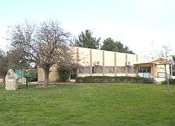
Kfar HaRif communal hall | |
 Kfar HaRif | |
| Coordinates: 31°44′38.75″N 34°47′44.16″E / 31.7440972°N 34.7956000°ECoordinates: 31°44′38.75″N 34°47′44.16″E / 31.7440972°N 34.7956000°E | |
| District | Southern |
| Council | Yoav |
| Affiliation | Agricultural Union |
| Founded | 1956 |
| Founded by | Moroccan Jews |
| Population (2015)[1] | 852 |
Kfar HaRif (Hebrew: כְּפַר הָרִי"ף, lit. Village of the Rif) is a moshav in southern Israel. Located on the border of the Shephelah and the Israeli coastal plain around 2 kilometres northeast of Kiryat Malakhi, it is the largest community under the jurisdiction of Yoav Regional Council. In 2015 it had a population of 852.
The HaRif creek, named after the community, is located to the east of the village. Nearby are some wells.
History
The moshav was founded at the end of 1956 by immigrants to Israel from Morocco, and was named after the Rif (medieval rabbi Isaac Alfasi), one of the great codifiers of Jewish law, who lived in Fez, Morocco. The founders were later joined by immigrants from several countries in Eastern Europe.
When it was founded, it joined the sector "HaMa'amad HaBeinoni" (the middle position) – a group of moshavim where the people who settled there paid for the economy they constructed, as opposed to most moshavim, which received their property for free from the government. Today, the moshav is part of the Agricultural Union.
In recent years, most residents have worked outside the community, while some continue to maintain an agricultural economy. The main branches of agriculture include orchards, vineyards, flowers and fowl.
References
- ↑ "List of localities, in Alphabetical order" (PDF). Israel Central Bureau of Statistics. Retrieved 16 October 2016.
External links
- Official website (Hebrew)