Khezhakeno
| Khezhakeno Kozabomi | |
|---|---|
| Village | |
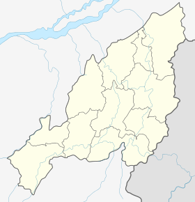 Khezhakeno  Khezhakeno Location in Nagaland, India | |
| Coordinates: 25°30′51″N 94°12′30″E / 25.51417°N 94.20833°ECoordinates: 25°30′51″N 94°12′30″E / 25.51417°N 94.20833°E | |
| Country |
|
| State | Nagaland |
| District | Phek |
| Elevation | 1,660 m (5,450 ft) |
| Population | |
| • Total | 3,281 (Census 2,011) |
| Languages | |
| • Local | Khezha (Chakhesang) |
| PIN | 797107 |
Khezhakeno is a village in the Phek District of Nagaland, India. It is a historical village of the Nagas. It is located in the region 25.30°N 94.12°E at an elevation of 1660 meters above sea level and shares its border with the Manipur state in the south. The village is 48 km from the state capital Kohima via NEC Viswema-Kedima-Zuketsa road and is 23 km away from its Sub-divisional headquarter Pfutsero. It is also one of the Administrative Circles headquarter of the state headed by an Extra Assistant Commissioner.
The village is inhabited by Khezha people belonging to a sub-tribe of Chakhesang Naga. Its natives, however, refer to the village and themselves as Kozabomi, meaning ‘the native people of Koza’, which is derived from their chief’s name ‘Koza’, who founded the village.
History
Khezhakeno also known as Kezakenoma [1] or Khezakenoma[2] was initially home to many Naga tribes until the dispersal of these tribes to different places. According to the history of Naga migration,[3][4] a particular wave of Naga tribes on crossing Burma (Myanmar), wandered through the valley of Imphal, Manipur, then moved northward and finally settled at the present site of Khezhakeno, Nagaland. This group stayed in and around Khezhakeno for a considerable period of time and finally dispersed to different regions for further settlement. Some Naga tribes that are known to have dispersed from Khezhakeno are Angami,[1] Chakhesang, Lotha,[5] Sumi,[6] Rengma [2] and numerous other clans.
The legend of final migration and settlement
Traditional folklore [7] as handed down from the ancestors speaks of the migrating group that on reaching Shajouba hill (near Tadubi, Manipur), they halted and sought for a divine intervention for their onward journey. As a result, the chief, accordingly thrust his walking stick into the ground for signs. Thereupon, the stick tilted toward the north-east direction and soon a swallow began to hover over them before taking off toward the direction to where the stick pointed. The group followed the bird until it stopped and hovered over at a place (Khezhakeno) where a large-flat stone laid. Here, the group experienced supernatural activities especially when before their very eyes they saw a frog with a stalk of paddy on its mouth hopped onto the large-flat stone, and as the frog left behind the paddy on the stone, to their amazement the paddy multiplied. All these signs and experiences convinced them of some divine guidance and consequently the group settled at the site.
This large-flat stone, also popularly known as Tso Tawo or "the magical-spirit Stone",[8] continued to play an important role in the livelihood of the early settlers. It was believed to have doubled the grain of paddies at the end of the day when dried on it in the sun. Although, its charm is said to have gone as it was burned and destroyed, the remnants of this legendary khezhakeno stone [9] is still preserved in its original location even today.
The expansion of the village
Since the settlement, the village grew and became more populated which resulted in the emergence of seven villages,[8] namely; (1) Khezhakeno (Kozabomi), (2) Movolomi,[10] (3) Chichülomi, (4) Pfulomi, 5) Tepfulomi, (6) Latsholomi and (7) Chiluomi (Cholumi). In due course of time, some villages got relocated to other region while some conglomerated back to the original parent village.
Demography
As per the Population Census of India 2011,[11] the village with a total of 606 household has a population of 3281 persons of which 1643 are males and 1638 are females. The average Sex Ratio is 997 which is higher than Nagaland state average of 931 and the Child Sex Ratio is 980.
The literacy rate of the village is 76.30%, where Male literacy is at 84.77% and female literacy rate at 67.83%.
Tourism
The village today has become a local tourist’s hotspot for its historical significance (historical sites), as well as for its natural beauty such as the Chida lake. The village, with the initiative from the Government of Nagaland, has a tourist bungalow for the keen tourists.
References
- 1 2 "Hutton, J.H., 1921 (1969), p-15, 19, The Angami Nagas"
- 1 2 Mills, J.P. 1937 (1982), p-11, The Rengma Nagas
- ↑ Ao, M. Alemchiba, 1970, p-20, A brief historical account of Nagaland, Naga Institute of culture, Kohima
- ↑ Nagaland Board of School Education, 1994, Nagaland (for standard IX & X)
- ↑ Ghosh, B.B., 1982, p-49 to p-55, History of Nagas
- ↑ "Hutton, J.H., 1921 (1968), p-5, The Sema Nagas".
- ↑ Zehol, Dr. Lucy, 1998, p-57, Ethnicity in Manipur: Experiences, Issues, and Perspectives
- 1 2 Ganguli, Milada, p-32, 33, A pilgrimage to the Nagas
- ↑ "The Khezhakeno stone, (Image p-18,19) The Angami Nagas".
- ↑ ""Movolomi", A reconstruction based on archaeobotanical evidence and radiocarbon dates" (PDF).
- ↑ "Census2011, Khezhakeno village Data".