Kimovsky District
| Kimovsky District Кимовский район (Russian) | |
|---|---|
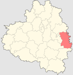 Location of Kimovsky District in Tula Oblast | |
 The settlement of Novolvovsk in Kimovsky District | |
.png) |
.png) |
|
| |
| Location | |
| Country | Russia |
| Federal subject | Tula Oblast[1] |
| Administrative structure (as of April 2013) | |
| Administrative center | town of Kimovsk[1] |
| Administrative divisions:[2] | |
| Towns under district jurisdiction | 1 |
| Rural okrugs | 19 |
| Inhabited localities:[2] | |
| Cities/towns | 1 |
| Rural localities | 150 |
| Municipal structure (as of April 2013) | |
| Municipally incorporated as | Kimovsky Municipal District[2] |
| Municipal divisions:[2] | |
| Urban settlements | 1 |
| Rural settlements | 2 |
| Statistics | |
| Area | 1,112 km2 (429 sq mi) |
| Population (2010 Census) | 42,853 inhabitants[3] |
| • Urban | 75.7% |
| • Rural | 24.3% |
| Density | 38.54/km2 (99.8/sq mi)[4] |
| Time zone | MSK (UTC+03:00)[5] |
| Official website | |
| Kimovsky District on WikiCommons | |
Kimovsky District (Russian: Ки́мовский райо́н) is an administrative district (raion), one of the twenty-three in Tula Oblast, Russia.[1] As a municipal division, it is incorporated as Kimovsky Municipal District.[2] It is located in the east of the oblast. The area of the district is 1,112 square kilometers (429 sq mi). Its administrative center is the town of Kimovsk.[1] Population: 42,853 (2010 Census);[3] 17,116 (2002 Census);[6] 20,480 (1989 Census).[7] The population of Kimovsk accounts for 66.5% of the district's total population.[3]
References
Notes
- 1 2 3 4 Law #954-ZTO
- 1 2 3 4 5 Law #547-ZTO
- 1 2 3 Russian Federal State Statistics Service (2011). "Всероссийская перепись населения 2010 года. Том 1" [2010 All-Russian Population Census, vol. 1]. Всероссийская перепись населения 2010 года (2010 All-Russia Population Census) (in Russian). Federal State Statistics Service. Retrieved June 29, 2012.
- ↑ The value of density was calculated automatically by dividing the 2010 Census population by the area specified in the infobox. Please note that this value is only approximate as the area specified in the infobox does not necessarily correspond to the area of the entity proper or is reported for the same year as the population.
- ↑ Правительство Российской Федерации. Федеральный закон №107-ФЗ от 3 июня 2011 г. «Об исчислении времени», в ред. Федерального закона №271-ФЗ от 03 июля 2016 г. «О внесении изменений в Федеральный закон "Об исчислении времени"». Вступил в силу по истечении шестидесяти дней после дня официального опубликования (6 августа 2011 г.). Опубликован: "Российская газета", №120, 6 июня 2011 г. (Government of the Russian Federation. Federal Law #107-FZ of June 31, 2011 On Calculating Time, as amended by the Federal Law #271-FZ of July 03, 2016 On Amending Federal Law "On Calculating Time". Effective as of after sixty days following the day of the official publication.).
- ↑ Russian Federal State Statistics Service (May 21, 2004). "Численность населения России, субъектов Российской Федерации в составе федеральных округов, районов, городских поселений, сельских населённых пунктов – районных центров и сельских населённых пунктов с населением 3 тысячи и более человек" [Population of Russia, Its Federal Districts, Federal Subjects, Districts, Urban Localities, Rural Localities—Administrative Centers, and Rural Localities with Population of Over 3,000] (XLS). Всероссийская перепись населения 2002 года [All-Russia Population Census of 2002] (in Russian). Retrieved August 9, 2014.
- ↑ Demoscope Weekly (1989). "Всесоюзная перепись населения 1989 г. Численность наличного населения союзных и автономных республик, автономных областей и округов, краёв, областей, районов, городских поселений и сёл-райцентров" [All Union Population Census of 1989: Present Population of Union and Autonomous Republics, Autonomous Oblasts and Okrugs, Krais, Oblasts, Districts, Urban Settlements, and Villages Serving as District Administrative Centers]. Всесоюзная перепись населения 1989 года [All-Union Population Census of 1989] (in Russian). Институт демографии Национального исследовательского университета: Высшая школа экономики [Institute of Demography at the National Research University: Higher School of Economics]. Retrieved August 9, 2014.
Sources
- Тульская областная Дума. Закон №954-ЗТО от 27 декабря 2007 г. «Об административно-территориальном устройстве Тульской области», в ред. Закона №2131-ЗТО от 11 июня 2014 г. «О внесении изменений в Закон Тульской области "Об административно-территориальном устройстве Тульской области" и Закон Тульской области "Об установлении границ административно-территориальных единиц – районов в городе Туле"». Вступил в силу по истечении десяти дней после дня официального опубликования. Опубликован: "Вестник Тульской областной Думы", №11–12(142–143), часть 4, ноябрь–декабрь 2007 г.. (Tula Oblast Duma. Law #954-ZTO of December 27, 2007 On the Administrative-Territorial Structure of Tula Oblast, as amended by the Law #2131-ZTO of June 11, 2014 On Amending the Law of Tula Oblast "On the Administrative-Territorial Structure of Tula Oblast" and the Law of Tula Oblast "On Establishing the Borders of the Administrative-Territorial Units–the Districts in the City of Tula". Effective as of the day which is ten days after the official publication date.).
- Тульская областная Дума. Закон №547-ЗТО от 11 марта 2005 г. «О переименовании муниципального образования — город Кимовск и Кимовский район Тульской области, установлении границ, наделении статусом и определении административных центров муниципальных образований на территории Кимовского района Тульской области», в ред. Закона №1898-ЗТО от 1 апреля 2013 г. «О преобразовании муниципальных образований на территории Кимовского района Тульской области и о внесении изменений в Закон Тульской области "О переименовании муниципального образования — город Кимовск и Кимовский район Тульской области, установлении границ, наделении статусом и определении административных центров муниципальных образований на территории Кимовского района Тульской области"». Вступил в силу через десять дней после официального опубликования. Опубликован: "Тульские известия", №66–69, 22 марта 2005 г. (Tula Oblast Duma. Law #547-ZTO of March 11, 2005 On Renaming the Municipal Formation of the Town of Kimovsk and Kimovsky District of Tula Oblast, on Establishing Borders, Granting the Status, and Establishing the Administrative Centers of the Municipal Formations on the Territory of Kimovsky District of Tula Oblast, as amended by the Law #1898-ZTO of April 1, 2013 On Transforming the Municipal Formations on the Territory of Kimovsky District of Tula Oblast and on Amending the Law of Tula Oblast "On Renaming the Municipal Formation of the Town of Kimovsk and Kimovsky District of Tula Oblast, on Establishing Borders, Granting the Status, and Establishing the Administrative Centers of the Municipal Formations on the Territory of Kimovsky District of Tula Oblast". Effective as of the day which is ten days after the official publication.).
| Cities and towns | |||
|---|---|---|---|
| Administrative districts | |||
Coordinates: 53°58′00″N 38°32′00″E / 53.9667°N 38.5333°E
This article is issued from Wikipedia - version of the 10/25/2014. The text is available under the Creative Commons Attribution/Share Alike but additional terms may apply for the media files.