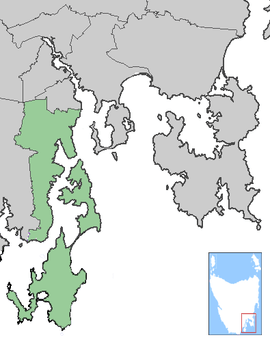
Kingborough Council, Tasmania
| Kingborough Council Tasmania | |||||||||||||
|---|---|---|---|---|---|---|---|---|---|---|---|---|---|
 Kingborough Council | |||||||||||||
| Coordinates | 43°00′36″S 147°13′12″E / 43.01000°S 147.22000°ECoordinates: 43°00′36″S 147°13′12″E / 43.01000°S 147.22000°E | ||||||||||||
| Population | 35,833 (2015 est.)[1] | ||||||||||||
| • Density | 49.98/km2 (129.44/sq mi) | ||||||||||||
| Area | 717 km2 (276.8 sq mi) | ||||||||||||
| Mayor | Steve Wass | ||||||||||||
| Council seat | Kingston | ||||||||||||
| Region | Kingston and Channel | ||||||||||||
| State electorate(s) | Franklin, Denison | ||||||||||||
| Federal Division(s) | Franklin, Denison | ||||||||||||
|
| |||||||||||||
| Website | Kingborough Council | ||||||||||||
| |||||||||||||
Kingborough Council (the Municipality of Kingborough) is a Local Government Area in Tasmania, Australia. Its seat and major town is Kingston, generally considered a satellite of the Tasmanian capital Hobart. Kingborough borders the Huon Valley Council and the City of Hobart, and covers the transition between the urban areas of the latter and rural of the later, as well as encompassing Bruny Island. Beyond Kingston important towns include Taroona, Kettering, Margate, Snug, Blackmans Bay and Woodbridge.
Etymology
The origin of Kingborough Council is a simple derivation from the name of the main town. The name Kingston was suggested by Mr Lucas in 1851, and the area had been known as Brown's River before then. Why he suggested this name is unknown. Mr Lucas' parents had been raised in England near New Kingston, they had come from Norfolk Island where the capital was Kingston or it might have been named after the Governor of New Norfolk Philip Gidley King.[2]
History
Kingborough Council's district was first settled by white colonialists in 1808, who settled at Brown's River (Promenalinah), named after Robert Brown, botanist in 1804. The town and district were both known as Brown's River during the earliest periods of settlement. The Lucas family settled the area and built The Red House, a prominent mansion which is now Kingston Golf Club. Early Kingston developed primarily around The Red House. Development of Kingborough was slow and the first post office opened only in the 1840s. The first road to Hobart, Proctor's Road, was opened in 1835.[2]
Kingston was proclaimed a town in 1851. The town's name was suggested by the then Police Magistrate, a member of the Lucas family. By 1890 Kingston had a population of 249 and in 1877 Keen's Curry was invented in the municipality.[2]
The area developed as a holiday area, especially the suburbs of Kingston Beach and Blackman's Bay. Margate and Kettering operated fishing fleets and Taroona created had a manufacturing industry, primarily through Taroona Shot Tower.[2] Sandfly became a center for small fruits and apple orcharding.[3] The decline of the apple industry progresses during the 1960s, but the industry collapsed entirely following the 1967 Tasmanian fires, when much of the municipality was devastated[4] and most orchards burnt down.[2] A memorial to the 62 fatalities of the fire was constructed in Snug following the fire, where 80 of the towns 120 buildings burned[5] and a permanent exhibition is present at the Channel Heritage Center.
References
- ↑ "3218.0 – Regional Population Growth, Australia, 2014–15". Australian Bureau of Statistics. Retrieved 29 September 2016.
- 1 2 3 4 5 "History of Kingston - Early Settlement". kingborough.tas.gov.au/. Kingborough Council. Retrieved 5 November 2015.
- ↑ Gardam, Julie (2014). Sandfly and surrounds (2nd ed.). Snug, Tasmania. Retrieved 1 August 2015.
- ↑ "Kingborough's rich heritage revealed". heritage.tas.gov.au. Heritage Tasmania. Retrieved 5 November 2015.
- ↑ "Snug Bushfire MemorialPrint". monumentaustralia.org.au. Monument Australia. Retrieved 5 November 2015.
External links
Local government areas of Tasmania grouped by areas | ||
|---|---|---|
| Central | ||
| Hobart area | ||
| Launceston area | ||
| North-east area | ||
| North-west and west coast | ||
| South-east area | ||
Southern region of Tasmania, Australia | |||||||
|---|---|---|---|---|---|---|---|
| City Other settlements | |||||||
| Governance former | |||||||
| Mountains |
| ||||||
| Protected areas, parks and reserves | |||||||
| Rivers | |||||||
| Harbours, bays, inlets and estuaries | |||||||
| Coastal features | |||||||
| Transport | |||||||
| Landmarks |
| ||||||
| Islands | |||||||
| Books and newspapers | |||||||
| Flora, fauna, and fishlife | |||||||
| Bioregions | |||||||
| Indigenous heritage | |||||||
| Other | |||||||
| |||||||