Kirtinagar
| Kirtinagar | |
|---|---|
| town | |
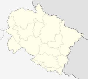 Kirtinagar  Kirtinagar Location in Uttarakhand, India | |
| Coordinates: 30°13′N 78°46′E / 30.22°N 78.76°ECoordinates: 30°13′N 78°46′E / 30.22°N 78.76°E | |
| Country |
|
| State | Uttarakhand |
| District | Tehri Garhwal |
| Population (2001) | |
| • Total | 1,040 |
| Languages | |
| • Official | Hindi |
| Time zone | IST (UTC+5:30) |
| PIN | 249161 |
| Telephone code | 9897101720 |
| Vehicle registration | UK |
| Sex ratio | 1:1 ♂/♀ |
| Website |
uk |
Kirtinagar is a town and a Nagar Panchayat and a Taluk in Tehri Garhwal district in the Indian state of Uttarakhand.
Geography
Kirtinagar is located at 30°13′N 78°46′E / 30.22°N 78.76°E.[1] Kirtinagar Taluk contains around 20 villages.[2]
History
Kirtinagar was founded by Garhwal Raja Kirti Shah by the Alaknanda River in response to the destruction by flood of nearby Old Srinagar in 1894.[3]
Demographics
As of the 2011 Census Kirtinagar has a population of 1,517, of which 41% are females and 10% are children up to 6 years of age. The average literacy rate is 81%, higher than the state average of 79%, with male literacy at 79%, and female literacy at 85%.[4] Over the ten years from 2001, the population has increased hugely, by 46% from 1040, and the proportions of females and children are both slightly down from their earlier 43% and 11% levels. Literacy is up from 76%.[5]
References
- ↑ "Yahoo maps location of Kirtinagar". Yahoo maps. Retrieved 2009-01-19.
- ↑ "Villages in Kirtinagar Taluk, Tehri Garhwal District, Uttarakhand". Soki.In. Retrieved 14 July 2015.
- ↑ Urbanization in Garhwal Himalaya: A Geographical Interpretation. New Delhi: Surendra Singh M.D. Publications Pvt. Ltd. 1 Jan 1995. Retrieved 14 July 2015.
- ↑ "Kirtinagar City Population Census 2011 - Uttarakhand". Census 2011 India. Retrieved 14 July 2015.
- ↑ "Census of India 2001: Data from the 2001 Census, including cities, villages and towns (Provisional)". Census Commission of India. Archived from the original on 2004-06-16. Retrieved 2008-11-01.