Kochas
| Kochas कोचस | |
|---|---|
| town | |
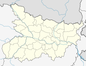 Kochas Location in Bihar, India | |
| Coordinates: 25°15′0″N 83°55′0″E / 25.25000°N 83.91667°ECoordinates: 25°15′0″N 83°55′0″E / 25.25000°N 83.91667°E | |
| Country |
|
| State | Bihar |
| District | Rohtas |
| Elevation | 69 m (226 ft) |
| Population (2001) | |
| • Total | 119,576 |
| Languages | |
| • Official | Bhojpuri, Hindi |
| Time zone | IST (UTC+5:30) |
| PIN | 821112 |
| Telephone code | 06184 |
| Coastline | 0 kilometres (0 mi) |
| Nearest city | Patna, Varanasi |
| Sex ratio | 1000 / 898 ♂/♀ |
| Literacy | 51.26% |
| Lok Sabha constituency | Sasaram |
| Climate | Mixed Climate (Köppen) |
| Avg. summer temperature | 47 °C (117 °F) |
| Avg. winter temperature | 23 °C (73 °F) |
Kochas is a town in Rohtas district of Bihar state, India. The most famous cultural event of Kochas is Krishn Lila unfortunately it is known and famous as "Kans Lila". Beside Krishn Lila other famous cultural activities are Chhath Pooja, Durga Pooja and other religious functions. Kochas's Surya Mandir sun temple is identity of Kochas. It is situated in center of a Pond "Pokhara".
The common occupation in the area are related to agriculture.Since paddy is main crop of area so Rice Processing Units commonly known as rice mills developed in surrounding area. After the economic reforms of 1991 Kochas gradually become a small business hub having shops of agricultural equipment/Tools.This small town fulfill the day to day requirements of the people living in villages in surrounding area.
There are various Institutes and schools fulfilling Educational need of the area. The Kochas Uchch Vidyalaya "Kochas High School" is prestigious school of Kochas founded by Shri kesho Tiwary a well-known Social activist of the circle.Another school is "Sri Ganga Paswan Harijan High School" (Samta School). Beside these two school various other Private schools like DAV School, Madarsa and Urdu schools are functioning. Sweets like “Piao”, “Gulab Jamun” and "Khurama" made by Bhikhari Shah Sweet shop is famous all over area. There are multiple bank branches available such as State Bank of India , Punjab National Bank, Bank Of India, Gramin Rohtas Bank etc.
Geography
It is located at an elevation of 69 m above MSL.[1]
Location
National Highway 30 passes through Kochas. The nearest airport is Patna Airport (Varanasi Airport).