Kornelimünster/Walheim
| Kornelimünster/Walheim | |
|---|---|
| Stadtbezirk of Aachen | |
 Kornelimünster/Walheim | |
| Coordinates: 50°43′17″N 6°10′49″E / 50.72139°N 6.18028°ECoordinates: 50°43′17″N 6°10′49″E / 50.72139°N 6.18028°E | |
| Country | Germany |
| State | North Rhine-Westphalia |
| District | Kornelimünster/Walheim |
| City | Aachen |
| Area | |
| • Total | 37.03 km2 (14.30 sq mi) |
| Population (2006-12-31) | |
| • Total | 16,070 |
| • Density | 430/km2 (1,100/sq mi) |
| Time zone | CET/CEST (UTC+1/+2) |
| Postal codes | 52076 |
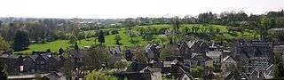
View of Kornelimünster, with Walheim on the horizon
Kornelimünster/Walheim is the southern-most district of Aachen, Germany, and borders the Eifel area of North Rhine-Westphalia, as well as Belgium. It became part of Aachen in 1972, after all of the communities surrounding the city were reorganized administratively.[1] The countryside is called Münsterländchen.
Communities
Kornelimünster
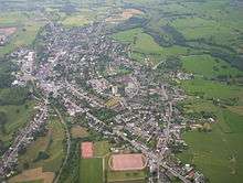
Aerial view of Walheim, 2005
- Kornelimünster, Administrative seat of the district, with historic town center
- Walheim, central business area of the district, and its largest community
- Friesenrath, on the border with the Eifel community of Roetgen
- Hahn, on the Inde River
- Lichtenbusch, German-Belgian border town with a border crossing for A44/E40
- Nütheim
- Oberforstbach, including an industrial park on Pascalstraße (especially for businesses specializing in information technology)
- Schleckheim
- Schmithof on the Vennbahn
- Sief, with border crossing to Raeren (Belgium)
- Eich
Pictures
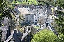
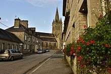
 Streetview of Kornelimünster
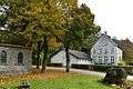 Streetview of Friesenrath
 Streetview of Schleckheim
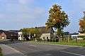 Streetview of Eich
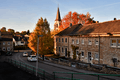 Streetview of Hahn
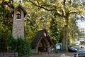 Streetview of Lichtenbusch
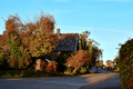 Streetview of Nütheim
 Streetview of Oberforstbach
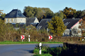 Streetview of Sief
 View of Schmithof
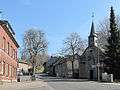
 Walheim church
Landmarks/Attractions

the Varnenum, an excavated temple complex from the Gallo-Roman era
- Kornelimünster’s historic city center, with timber framed structures on the Inde River
- former Kornelimünster Abbey, now the site of the Art of NRW, which is open to the public
- Kornelimünster Abbey gardens
- Provost Kornelimünster Church (originally from 814-817 AD)
- Varnenum - Excavations at Kornelimünster of a Gallo-Roman temple system
- former quarry and lime kiln in Walheim and Hahn (with posted information boards)
- Former quarry in Walheim now a large public space with playgrounds, minigolf, barbecue facilities and access to the Vennbahn path
- Historic landmark, St. Stephanus Church and cemetery
- Historic landmark, Maria in the Snow Chapel
- St. Anthony-Chapel, a small church that was destroyed in an earthquake and rebuilt in the 18th century
- Iter and Inde valley
Events
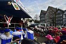
Open air carnival Kornelimünster
- Historical fairground (Kornelimünster)
- Thanksgiving (Walheim)
- Carnival (Lichtenbusch/Oberforstbach)
- Open air carnival (Kornelimünster)
- Festival of stars (Schleckheim)
Twin towns and sister cities
Montebourg - L'église Saint-Jacques
- Montebourg (France), a sister city of Walheim since 1960, which was carried over to the district after Kornelimünster and Walheim were merged in 1972. Montebourg is a commune in the Manche department (Basse-Normandie) in Normandy in north-western France. It is located southeast of Cherbourg.
References
- ↑ Bünermann, Martin; Köstering, Heinz (1975). Communities and Districts After the Area Community Reform in North Rhine-Westphalia (Die Gemeinden und Kreise nach der kommunalen Gebietsreform in Nordrhein-Westfalen). Köln: German Publishing Community (Deutscher Gemeindeverlag). ISBN 3-555-30092-X.
External links
| Wikimedia Commons has media related to Kornelimünster/Walheim. |
Districts of Aachen | ||
|---|---|---|
This article is issued from Wikipedia - version of the 11/19/2016. The text is available under the Creative Commons Attribution/Share Alike but additional terms may apply for the media files.