Kraichbach
| Kraichbach | |
|---|---|
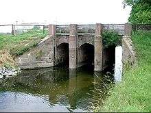 The Kraichbach between Hockenheim and Ketsch. | |
| Basin | |
| Main source |
300 m (980 ft) 49°2′33″N 8°50′48″E / 49.04250°N 8.84667°E |
| River mouth |
93 m (305 ft) 49°21′48″N 8°30′54″E / 49.36333°N 8.51500°ECoordinates: 49°21′48″N 8°30′54″E / 49.36333°N 8.51500°E |
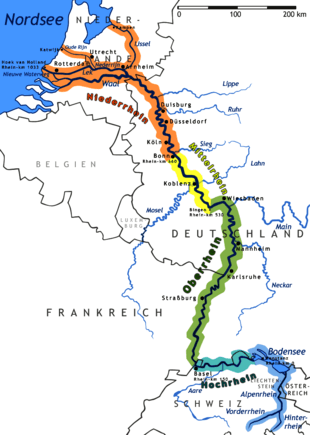
| Progression | Rhine → North Sea |
| River system | Rhine |
| Physical characteristics | |
| Length | 59.9 km (37.2 mi) |
The Kraichbach is a 60 km long right tributary of the Rhine River running through the German state of Baden-Württemberg. Its source is in the Kraichgau region near the municipality of Sternenfels. The brook then flows to the northwest through Kürnbach, Oberderdingen, Kraichtal, Ubstadt-Weiher, Bad Schönborn and Kronau, all in the district of Karlsruhe. It then enters the district of Rhein-Neckar-Kreis and flows through Sankt Leon-Rot, Reilingen, Hockenheim and Ketsch before joining the Rhine.
Notable locations near the stream include Gochsheim Castle, Schloss Kislau prison, and the Hockenheimring racing circuit.
Tributaries of the Rhine | ||
|---|---|---|
| Left (western) |
|  |
| Right (eastern) |
| |
This article is issued from Wikipedia - version of the 5/30/2016. The text is available under the Creative Commons Attribution/Share Alike but additional terms may apply for the media files.