Spiegelbach
| Spiegelbach | |
|---|---|
|
Spiegelbach splits away from Quiech north of Ottersheim | |
| Country | Germany |
| Basin | |
| Main source |
Weir splitting Spiegelbach off of Queich, north of Ottersheim 122 m (400 ft) 49°12′33.26″N 8°14′13.19″E / 49.2092389°N 8.2369972°E |
| River mouth |
Confluence with Rhine, southwest of Sondernheim, 100 m (330 ft) 49°11′6.25″N 8°20′43.76″E / 49.1850694°N 8.3454889°ECoordinates: 49°11′6.25″N 8°20′43.76″E / 49.1850694°N 8.3454889°E |
| Progression | Rhine → North Sea |
| River system | Rhine |
| Basin size | 54.592 km2 (21.078 sq mi) |
| Physical characteristics | |
| Length | 9.2 km (5.7 mi) |
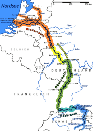
The Spiegelbach is a river in the southern Palatinate. It arises as a diversion of the Queich, which rises in the Palatinate forest, and thus has no separate source. It flows into the Rhine at Sondernheim.
After a devastating flood in 1745, in which the mills on the Altbach and Brühlgraben were flooded, it was decided to create a diversion from the Queich towards Bellheim, in order to provide the newly built mills with a steady supply of water. From the weir on the boundary of the districts Ottersheim and Knittelsheim, the Spiegelbach flows 9.2 kilometres (5.7 mi) before reaching the Old Rhine at Sondernheim.
This article is issued from Wikipedia - version of the 6/11/2016. The text is available under the Creative Commons Attribution/Share Alike but additional terms may apply for the media files.
