Kromołów, Opole Voivodeship
| Kromołów | |
|---|---|
| Village | |
|
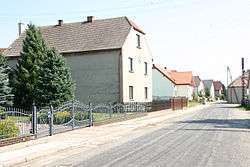
A road through Kromołów | |
 Kromołów | |
| Coordinates: 50°24′2″N 17°58′19″E / 50.40056°N 17.97194°E | |
| Country |
|
| Voivodeship | Opole |
| County | Krapkowice |
| Gmina | Walce |
| Population | 469 |
Kromołów [krɔˈmɔwuf] is a village in the administrative district of Gmina Walce, within Krapkowice County, Opole Voivodeship, in south-western Poland.[1] It lies approximately 4 kilometres (2 mi) north-west of Walce, 8 km (5 mi) south of Krapkowice, and 30 km (19 mi) south of the regional capital Opole.
Before 1945 the area was part of Germany (see Territorial changes of Poland after World War II).
The village has a population of 469.
References
| Wikimedia Commons has media related to Kromołów, Opole Voivodeship. |
| Seat | ||
|---|---|---|
| Other villages | ||
Coordinates: 50°24′2″N 17°58′19″E / 50.40056°N 17.97194°E
This article is issued from Wikipedia - version of the 5/4/2015. The text is available under the Creative Commons Attribution/Share Alike but additional terms may apply for the media files.