Kuandian Manchu Autonomous County
| Kuandian County 宽甸县 ᡴᡠᠸᠠᠨᡩᡳᠶᠠᠨ ᠰᡳᠶᠠᠨ | |
|---|---|
| Autonomous county | |
宽甸满族自治县 Kuandian Manchu Autonomous County | |
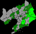
 Location in Dandong City | |
 Kuandian Location of the county seat in Liaoning | |
| Coordinates: 40°44′N 124°47′E / 40.733°N 124.783°ECoordinates: 40°44′N 124°47′E / 40.733°N 124.783°E | |
| Country | People's Republic of China |
| Province | Liaoning |
| Prefecture-level city | Dandong |
| County seat | Kuandian Town (宽甸镇) |
| Area | |
| • Total | 6,193.7 km2 (2,391.4 sq mi) |
| Elevation | 284 m (932 ft) |
| Population | |
| • Total | 434,000 |
| • Density | 70/km2 (180/sq mi) |
| Time zone | China Standard (UTC+8) |
| Postal code | 118200 |
Kuandian Manchu Autonomous County (simplified Chinese: 宽甸满族自治县; traditional Chinese: 寬甸滿族自治縣; pinyin: Kuāndiàn Mǎnzú Zìzhìxiàn; Manchu: ᡴᡠᠸᠠᠨᡩᡳᠶᠠᠨ
ᠮᠠᠨᠵᡠ
ᠪᡝᠶᡝ
ᡩᠠᠰᠠᠩᡤᠠ
ᠰᡳᠶᠠᠨ), is a county of eastern Liaoning province, People's Republic of China, bordering North Korea to the southeast and Jilin in the northeast. It is under the administration of Dandong City, the centre of which lies 75 kilometres (47 mi) to the southwest, and is served by China National Highway 201. In Kuandian is the Hushan Great Wall, the most easterly section of the Great Wall of China. A short reconstruction of the wall is open to tourists. The area has an abandoned airstrip that was used by the Chinese airforce during the Korean War.
Administrative divisions
There are 19 towns, 2 townships and 1 ethnic township in the county.[1]
Towns:
- Kuandian (宽甸镇), Guanshui (灌水镇), Taipingshao (太平哨镇), Yongdian (永甸镇), Changdian (长甸镇), Maodianzi (毛甸子镇), Qingshangou (青山沟镇), Hongshi (红石镇), Niumaowu (牛毛坞镇), Dachuantou (大川头镇), Bahechuan (八河川镇), Shuangshanzi (双山子镇), Daxicha (大西岔镇), Budayuan (步达远镇), Zhenjiang (振江镇), Qingyishan (青椅山镇), Yangmuchuan (杨木川镇), Hushan (虎山镇), Penghai (硼海镇)
Townships:
- Gulouzi Township (古楼子乡), Shihugou Township (石湖沟乡), Xialuhe Korean Ethnic Township (下露河朝鲜族乡)
Geography and climate
Kuandian occupies the eastern half of Dandong City and is situated among the Changbai Mountains, on the northwest (right) bank of middle-lower reaches of the Yalu River, across which it borders the North Korean provinces of North Pyongan and Chagang. Domestically, it borders Ji'an (Jilin) to the northeast, Fengcheng to the west, Benxi to the northwest, and Huanren County to the north. It has a total area of 6,193.7 km2 (2,391.4 sq mi) and 216.5 km (134.5 mi) of the Sino-Korean border.[2]
Kuandian has a monsoon-influenced humid continental climate (Köppen Dwa) characterised by very warm, humid summers, due to the monsoon, and long, cold, and very dry winters, due to the Siberian anticyclone. The four seasons here are distinctive. A majority of the annual rainfall occurs in July and August. The monthly 24-hour average temperatures ranges from −11.5 °C (11.3 °F) in January to 22.5 °C (72.5 °F) in July, while the annual mean is 7.13 °C (44.8 °F). Due to the mountainous location, temperatures tend to be cooler, and summer rainfall is heavier. The average relative humidity is 70%, and the frost-free period is 140 days.[2]
| Climate data for Kuandian (1971−2000) | |||||||||||||
|---|---|---|---|---|---|---|---|---|---|---|---|---|---|
| Month | Jan | Feb | Mar | Apr | May | Jun | Jul | Aug | Sep | Oct | Nov | Dec | Year |
| Record high °C (°F) | 6.4 (43.5) |
14.5 (58.1) |
18.3 (64.9) |
28.3 (82.9) |
33.3 (91.9) |
35.7 (96.3) |
36.5 (97.7) |
35.0 (95) |
30.4 (86.7) |
27.0 (80.6) |
18.7 (65.7) |
9.1 (48.4) |
36.5 (97.7) |
| Average high °C (°F) | −4.2 (24.4) |
−0.5 (31.1) |
6.0 (42.8) |
14.9 (58.8) |
21.0 (69.8) |
24.7 (76.5) |
26.8 (80.2) |
27.2 (81) |
22.6 (72.7) |
15.6 (60.1) |
5.9 (42.6) |
−1.6 (29.1) |
13.2 (55.8) |
| Daily mean °C (°F) | −11.5 (11.3) |
−7.4 (18.7) |
0.2 (32.4) |
8.3 (46.9) |
14.6 (58.3) |
19.4 (66.9) |
22.5 (72.5) |
22.2 (72) |
16.1 (61) |
8.8 (47.8) |
0.2 (32.4) |
−7.8 (18) |
7.1 (44.8) |
| Average low °C (°F) | −17.7 (0.1) |
−13.6 (7.5) |
−5.4 (22.3) |
1.8 (35.2) |
8.3 (46.9) |
14.3 (57.7) |
18.9 (66) |
18.0 (64.4) |
10.4 (50.7) |
3.0 (37.4) |
−4.6 (23.7) |
−13.2 (8.2) |
1.7 (35.0) |
| Record low °C (°F) | −34 (−29) |
−31.5 (−24.7) |
−28.2 (−18.8) |
−9.9 (14.2) |
−1.8 (28.8) |
5.2 (41.4) |
10.4 (50.7) |
5.2 (41.4) |
−1.2 (29.8) |
−8.4 (16.9) |
−22.3 (−8.1) |
−33.1 (−27.6) |
−34 (−29) |
| Average precipitation mm (inches) | 10.4 (0.409) |
12.5 (0.492) |
19.0 (0.748) |
50.7 (1.996) |
74.6 (2.937) |
129.7 (5.106) |
284.7 (11.209) |
274.8 (10.819) |
92.6 (3.646) |
52.2 (2.055) |
34.4 (1.354) |
15.5 (0.61) |
1,051.1 (41.381) |
| Average precipitation days (≥ 0.1 mm) | 5.2 | 4.7 | 5.8 | 8.9 | 10.7 | 13.0 | 16.8 | 13.4 | 9.0 | 7.7 | 7.3 | 5.5 | 108.0 |
| Source: Weather China[2] | |||||||||||||
References
- ↑ 2011年统计用区划代码和城乡划分代码:宽甸满族自治县 (in Chinese). National Bureau of Statistics of the People's Republic of China. Retrieved 2012-07-17.
- 1 2 3 宽甸 - 气象数据 -中国天气网 (in Chinese). Weather China. Retrieved 2012-07-17.


