Kunkels Pass
| Kunkels Pass | |
|---|---|
 | |
| Elevation | 1,357 m (4,452 ft) |
| Traversed by | Road |
| Location | Graubünden, Switzerland |
| Range | Glarus Alps |
| Coordinates | 46°51′22″N 9°24′42″E / 46.85611°N 9.41167°ECoordinates: 46°51′22″N 9°24′42″E / 46.85611°N 9.41167°E |
 Location in Switzerland | |
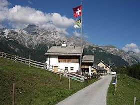
The Kunkels Pass (German: Kunkelspass) (el. 1,357 m) is a mountain pass in Eastern Switzerland across the Glarus Alps. It connects Vättis in the canton of St. Gallen to Tamins in the canton of Graubünden. The pass itself is located south of the hamlet of Kunkels within Graubünden. The Kunkels Pass is traversed by a small road.
The pass is overlooked by the Ringelspitz and by the Calanda.
References
- Swisstopo maps
External links
 Media related to Kunkelspass at Wikimedia Commons
This article is issued from Wikipedia - version of the 5/9/2016. The text is available under the Creative Commons Attribution/Share Alike but additional terms may apply for the media files.